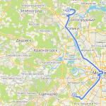
Days 5-10 Providence Bay
If you believe the legend, the intricately indented bay in the Anadyr Bay of the Bering Sea was discovered in 1660 during the scientific expedition of Kurbat Ivanov to Cape Chukotka. However, the name of this picturesque place appeared almost two centuries later, when in 1848-1849. The English ship Plover, under the command of Captain Thomas Moore, had to anchor here and wait out the harsh local winter.
The ship set sail from Plymouth, England in January 1848 and cruised the Bering Sea in search of Franklin's lost expedition. The bay became their salvation - stormy winds and bad weather crept up quickly and unexpectedly, and providence itself sent them this quiet and cozy harbor literally a matter of days from death. The name was supported by the entire team - Providence Bay acquired its new name.
The village of the same name appeared in the bay much later. In 1937, a decision was made to build a port. Three years later, the reliable harbor was already open and ready to receive cargo at the wall of the first berth.
Days 11-13 Gulf of Lawrence
The route will pass along the State nature reserve Beringia is the easternmost protected area of Russia. The extreme eastern point of Russia, Cape Dezhnev, is located within the park.
Exceptional geographical position at the junction of two continents and two oceans has transformed the region Bering Strait into a kind of migration corridor and crossroads of birds, sea and animals from different regions of the planet. This place has preserved traces of the ancient Bering Sea culture of whalers and reindeer herders, inaccessible landscapes of the coast and tundra, unique flora and fauna that can tell the secrets of the past.
Day 12 Bering Strait
You will have to travel from the Gulf of Lawrence to the city of Wales through the Bering Strait and cross the border between Russia and the United States. The Bering Strait runs between Asia and North America. It is 55 miles (90 km) wide and ranges from 30-50 m (98-160 ft) in depth. The strait freezes completely from October to June.
The Russian coast of the Bering Strait was a closed military zone. It was possible to get there only through organized trips and special permits. Foreigners arriving at the port after crossing the strait and all arriving at Anadyr Airport or Providence Bay without special permits were considered unauthorized travelers. Even with visas, they could be arrested, jailed, fined and deported.
The Bering Strait is the official border, the demarcation line of which runs equidistant (1.5 km) from the Diomede Islands. At the same time, the Russian and American sides live on different calendar days - with a difference of 21 hours.
The Diomede Islands are located in the middle of the strait. Big Diomede is a Russian island, and Little Diomede is an American island. The islands are separated by an international border. Little Diomede is called Ignaluk in its native language, and it is also known as Krusenstern Island. Due to the large time difference, Big Diomede is called "Tomorrow Island" and Little Diomede is called "Yesterday Island".
Day 14 Finish in Nome
The route will pass along the Bering Land Bridge or Beringia Nature Reserve, located on the Seward Peninsula - the remnant of a land isthmus between North America and Asia that existed 13 thousand years ago - and the adjacent islands: Sarycheva and others. On the territory of the reserve there is a fairly large, by local standards, the city of Shishmarev.
The reserve was founded on December 1, 1978 to protect unique landscapes north coast with lakes, lava flows and hot springs. It is dominated by tundra and swamps, home to 112 species of birds.
Nome is known as the final destination for the world's most prestigious races. dog sledding Iditarod (Anchorage to Nome, 1868 km).
At the beginning of 1925, a diphtheria epidemic began in Nome, threatening to destroy the city's population. There was no required amount of serum in the city, and due to difficult weather conditions it was impossible to deliver it to the city by air. The serum was delivered to the city by dog sleds, replacing each other all the way from the city of Nenana (where the serum was delivered by train, more than 1000 km from Nome). 20 mushers and about 150 dogs took part in the race. The race to deliver anti-diphtheria serum to Nome lasted 5.5 days in stormy weather conditions and was called the Great Race of Mercy.
The impossible is possibleEvgeny Novitsky
Russian Bazaar No. 25(687) June 18 - 24, 2009
The two most popular ways to enter the United States without documents are to cross the US-Mexico border and take a boat to the Florida coast. The first method is successfully used by millions of Mexicans, and the second by Cubans, Dominicans, Guatemalans and Hondurans. Both are opposed by thousands of representatives of the National Guard and ICE immigration police (Immigration and Customs Enforcement), who are well aware of all methods of illegal entry into the country.
Few people know about this, but there is a third loophole that allows you to enter the territory of the United States - this is the Bering Strait, which separates the Russian Chukotka and American Alaska. The shortest distance between the two continents is only 55 miles, which theoretically can be covered in an hour and a half by motor boat.
“One can only guess at the number of illegal immigrants who enter the United States through the Bering Strait on fishing boats, inflatables and motor boats, says Charles Kozik, an activist with the Coalition Against Illegal Immigration (CAII). “Over the past ten years, we have not received a single comment from ICE management on this issue...”
Kozik and his like-minded people call Alaska a “state without borders”, since its territory is practically not guarded by border guards - neither with the help of helicopters, nor with the help of ships, nor with the help of infantrymen.
Last year, backpacker Joseph Havanes from Washington state alone covered the distance from Chukotka to the American town of Teller. The journey took a day, and the “defector” did not meet a single person on his way. “I bought all the necessary equipment in an ordinary tourist store, spending $650,” admits Havanes. “Any hardy person can get to America from the Russian mainland...”
It should be noted that electronic compasses, night vision devices, binoculars, ultra-warm jackets, ultra-light inflatable boats, sprays to repel wild animals - all this is available for free sale, both in Russia and in the USA. Therefore, it is possible to thoroughly prepare for the “taking of the Bering Strait.” In the end, the legendary American athlete Lynn Cox managed to swim across the strait, which means that nothing is impossible for a potential illegal immigrant.
It is important to say that Alaska police officers are indifferent to travelers coming from the West, unlike their colleagues from Arizona, New Mexico and Texas, who stop almost every Latino who finds himself near the Mexican-American border.
A few weeks ago, rumors leaked to the Korean press that fishing schooners earn money by transporting illegal immigrants to the shores of America. Allegedly, for a decent reward, anyone can be launched on a rubber boat in relative proximity to Alaska.
“In late July and early August, when the temperature in Alaska reaches 70 degrees Fahrenheit, travel turns into an exciting hike,” says one of these illegal immigrants. “First you get to the roadway, then you catch a car and after a few hours you find yourself at the hotel...”

Many readers will probably ask the question: why move to Alaska if living conditions in this state are radically different from living conditions in New York or Los Angeles? What is the point of living without documents in a “snowy meadow”, sandwiched between Canada and Chukotka?
The answer is simple: from Alaska you can go anywhere in the United States without an immigrant visa. Since this state is considered American territory, any flight to California, Texas, New York or Hawaiian Islands considered "internal". Consequently, the requirements for documents are completely different. American laws state that to fly within the United States you need an airline ticket and a photo ID, that is, a state ID, a green card, a US passport or... a foreign passport.
With the latest document, illegal immigrants can go anywhere. Although in practice it happens that airport employees still find fault with the lack of a visa in the passport. However, here everything depends on the personal qualities of the officer to whom you end up. Perhaps he will take a quick look at your passport, or perhaps he will immediately contact the ICE unit, which is located at every airport.
There are a huge number of stories floating around on the Internet about natives of Russia, China and Korea crossing the Bering Strait. In particular, one of the users boasts that on a three-person inflatable kayak you can get to Alaska in two and a half hours. The main thing is that all passengers are good rowers. “The success of the trip depends on the physical preparation of its participants and technical means - a compass, a GPS system and a scanner that determines the location of ships,” adds the unnamed illegal immigrant.
A user under the nickname Hans generally claims that he reached New York through Alaska and Canada without documents. He crossed the American-Canadian and Canadian-American borders on foot under cover of darkness. He moved with the help commuter buses, trains and taxis.
By the way, Hans' story is quite similar to the truth. The border between the United States and Canada is, by and large, a checkpoint with one checkpoint manned by one officer for several dozen miles. This is understandable: there are too few people willing to move illegally from one successful country to another.
"Smile, European appearance and knowledge in English“These are the three main means against the immigration police,” admits Hans. “During the six weeks of my extreme journey, not a single person suspected me of illegally crossing state borders.”
One of the Internet forum users called illegal immigrants making their way to America through Alaska “desperate adventurers.” In my opinion, a very accurate definition. Judge for yourself: Alaska became part of the United States in 1867, and the authorities have still not recorded a single mass arrest of illegal immigrants from Korea, China and Russia, who, according to unconfirmed reports, enter the continent in the thousands.
"Some people don't know what's going on at the border, and others prefer to keep quiet," said Alaska native Pete Bogarski, a resident of the coastal town of Alakanuk. “Today many foreigners want to get into America, and if there is demand, then there will be supply...”
However, it is unlikely that the Department of Homeland Security (DHS) and ICE immigration police will ever want to take the border of the large state under your control. There are too few facts of illegal entry into Alaska, and effective bills and innovations at the federal level require a high-profile precedent...
Depths off the coast reach 43 meters.
The coast is rocky, covered in blocky screes, with a narrow strip of coastal beach, only the northern coast is relatively flat. A polar station is also located there. There are several rivers, two of them flow from the center of the island to the north, one flows from the top of Mount Roof to the southeast. The length of the island from north to south is 8.7 km, from east to west - 4.7 km. Extreme northern point islands - Cape Vsadnik, to the east of which is Cape Skalisty. The most southern point islands - South Cape.
The island's infrastructure is relatively developed, there is a polar station, a border post and many different buildings along the shores of the island and south of the center.
Today there are no representatives of the indigenous population on the island, but there are border troops present, since the island is located on the border of North America and Asia.
Big Diomede Island is washed by the Pacific and Arctic oceans, and therefore has great strategic importance. Ratmanov Island is geographical point, Where New Year in Russia it comes first, because when it’s midnight on the island, western border Russia 12 hours 35 minutes of the previous day.
Fauna
One of the largest bird colonies in the region is located on Ratmanov Island; in total, 11 species of seabirds with a total number of over 4 million individuals have been recorded. In June 1976, a buffy hummingbird was observed here - the only species of hummingbird whose migration has been recorded in Russia.
There is a large walrus rookery on the island, and mass migrations of gray whales occur in the coastal waters
The eastern island (about 5 sq. km) - Krusenstern Island (Little Diomede, Eskimo name Ingalik - (“opposite”) and Fairway Rock belong to the United States.
The distance between the islands is 4160 m and the state border of Russia and the USA and the international date line pass between them.
The time difference is 23 hours. So when residents on Little Diomede look across the strait to Big Diomede, they are not just looking at another country, they are “studying tomorrow.” For example, when in the USA it is 9:00 on Saturday on the Little Diomede, then in Russia it is 6:00 on Sunday on the Big Diomede. Because of this, they are sometimes called Tomorrow Island and Yesterday Island.
Both islands have a flat top, steep slopes and a location isolated by rough seas. Permanent fog covers the islands during the warmer months, and in winter, moving pieces of ice collide in open waters, forming an ice bridge connecting the two islands. In times like these, you can practically walk between the United States and Russia. Of course, this can only be done in theory. Crossing the Bering Strait is not permitted by law. However, since 1989 there has been an agreement between the USSR (now Russia) and the USA on visa-free travel local residents to visit each other.
The islands were originally inhabited by Eskimos, 3,000 years ago. The islands were first noticed in 1648 by the pioneer Cossack Semyon Dezhnev. about which there is a written report dated April 15, 1655. The official discovery is associated with the first expedition to Kamchatka, which took place in 1728. During it, Bering discovered an island called Diomede, as it was found on the day of St. Diomede. In Russian Orthodox Church this is the day of remembrance of the martyr Diomede. And in 1732, the Diomede Islands were first put on the map by Ivan Fedorov and Mikhail Gvozdev. Modern names were assigned in 1815 by Lieutenant Otto Kotzebue (Krusenstern Island and Ratmanov Island).
When the United States bought Alaska from Russia in 1867, the treaty included Krusenstern Island (Little Diomede). New frontier was carried out between these two islands.
Inupik-speaking Eskimos lived on both islands until the mid-20th century. They engaged in barter trade with Asian and American tribes, so when creating their cultural traditions, they adopted customs that already existed on both continents.
From 1905 to 1933, there was a gradual migration of indigenous people from Ratmanov Island to the neighboring one - american island Kruzenshtern. With the beginning of the Cold War, through the efforts of the Soviet side, the remaining residents were forcibly resettled to the mainland of Chukotka. Big Diomede became a Russian military base
Since 1916, due to weak security northern borders An American trading post operated illegally on the island and did not pay customs duties. In September 1925, the border patrol ship Vorovsky arrived at Ratmanov Island, after which the Americans were forced to leave Soviet territory. In 1941, a border post was created on the island.
Little Diomede has developed into a small community of 75 inhabitants, with a church and school. The Eskimos of Little Diomede fish and crab, and hunt beluga whales, walrus, seals and polar bears. Food and mail are delivered by barge from the mainland.
In 2005, a seven-meter Orthodox cross was erected on the island, installed on the very high hill, which is clearly visible to residents of neighboring Alaska and ships passing through the Bering Strait.
On the initiative of Bishop Diomede (Dzyuban) of Anadyr and Chukotka, on August 25, 2005, an Orthodox worship cross was installed at the extreme eastern point of Russia.
Bishop Diomede arrived on the island on board the military ship "Captain Sipyagin". The seven-meter cross is installed on the highest hill of the island, called Skalista, and is clearly visible to residents of neighboring Alaska and captains of ships passing through the Bering Strait. From the place of disembarkation from the ship to Skalistaya - almost three kilometers. Border guards helped carry the parts of the wooden cross. The cross was erected next to the observation post.
.According to some plans, passage through the island is possible car tunnel, which will connect Eurasia and North America.
The idea of creating a transport artery between Alaska and Russia was first expressed in 1890 by Colorado Governor William Gilpin. He talked about the possibility of building a giant bridge. In the 40s and 60s of the 20th century, this idea was again discussed at the highest level.
“Today, a number of American specialists are raising the question of connecting the coasts of Asia and America with a tunnel along the line of the Diomede Islands located in the Bering Strait,” wrote Corresponding Member of the RAS V.A. LAMIN, General Director of the Joint Institute of History, Philology and Philosophy of the SB RAS. “True, The authors of the modern initiative, unlike its predecessors, are focused primarily on the development of the engineering and technical aspects of the structure: it is assumed that it can be successfully implemented in the first quarter of the 21st century and its financing is not a problem. At the same time, the range of technical and operational parameters of the tunnel is not limited. only by rail. All types of modern communications will be laid in it: from cable communication lines to pipelines and energy transmission systems."
Construction of the tunnel is a far-reaching project. Today, there are no necessary road and railway connections on Russian and American territories. To be built on the American side motorway with a length of more than 1200 km. Moreover, construction may slow down due to sharp protests from environmentalists. On Russian territory, the nearest route begins in Magadan at a distance of 1600 km from the tunnel. The situation with railway tracks is not much better.
On the American side, the closest road starts in Prince George. It is necessary to build a rail bed almost 2000 km long.
On Russian territory it will be necessary to build a railway line that will connect the tunnel with the Trans-Siberian Railway.
The cost of this project was estimated at $128 billion. The projected length of the tunnel, which will connect Chukotka and Alaska, is almost 100 km. Construction will take at least 20 years. This is the largest project of its kind in history, noted the German newspaper Die Welt.
The tunnel was supposed to be built in one of the most remote areas globe. In the narrowest part of the Bering Strait, Russia and Alaska are separated by only 37 km, and in the area of the Diomede Islands - only 5.8. However, for safety reasons, experts recommended that the tunnel should not be built along the shortest path, so that as a result its length would be 96 kilometers.
According to Viktor Razbegin, who was involved in this project at the Ministry of Economics, we are talking about “one of the very few projects that can radically change the development of the Russian Far East“He believed that “the chances of its implementation are quite good.” The United States, Russia and Canada were close to making a decision on the construction of such a tunnel back in 1998, but discussions were stopped after the default in Russia.
South of the Arctic Circle to the edge of the Bering Sea there is a narrow strip of sea called the Bering Strait. This is the sea passage between Chukotka (Siberia) and Alaska that separates the United States and Russia.
The waters of the strait wash the easternmost point of the Asian continent (Cape Dezhnev) and the most western point North American continent (Cape Prince of Wales). The Bering Strait is a link between the waters of the Pacific Ocean (Bering Sea) and the Arctic waters of the Arctic Ocean (Chukchi Sea).
The Russian coast of the Bering Strait was a closed military zone. It was possible to get there only through organized trips and special permits. Foreigners arriving at the port after crossing the strait and all arriving at Anadyr Airport or Providence Bay without special permits were considered unauthorized travelers. Even with visas, they could be arrested, jailed, fined and deported.
The Bering Strait is 55 miles (90 km) wide, between Asia and North America. The strait usually freezes completely from October to June. Its depth ranges from 30-50 meters (98-160 feet).
The Bering Strait is the official border, the demarcation line of which runs equidistant (1.5 km) from the Diomede Islands. At the same time, the Russian and American sides live on different calendar days - with a difference of 21 hours (20 hours during the transition to daylight saving time).

The Diomede Islands are located in the middle of the strait. Big Diomede is a Russian island and Little Diomede is an American island. The islands are separated by an international border. Little Diomede is called Ignaluk in its native language, and it is also known as Krusenstern Island. Due to the large time difference, Big Diomede is called "Tomorrow Island" and Little Diomede is called "Yesterday Island".
The land on the Alaskan side belongs to the Nome area—population just over 9,000. There are no roads from the sound to Alaska's main cities, and few roads exist around Nome.
The Russian coast belongs to the Chukotka Autonomous Okrug. Roadless Provideniya Bay (4,500 people) and Chukotka District (5,200 people) lie along the strait.

The narrowness of the strait allows small boats to cross the distance from Russia's Chukchi Peninsula to Alaska's Seward Peninsula. Traditionally, indigenous peoples in the area frequently crossed the border back and forth "for routine visits, seasonal festivals and daily trade", but were prevented from doing so during the Cold War. The border became known as the "Ice Curtain".

- In 1998, Russian traveler Dmitry Shparo and his son Matvey crossed the frozen Bering Strait on skis.
- In March 2006, Briton Carl Bushby and French-American adventurer Dimitri Huener crossed the strait on foot, covering 90 km of the frozen section in 15 days. They were soon arrested for entering Russia without border control.
- In August 2008, the first crossing of the Bering Strait on an amphibious road vehicle was marked. A specially modified Land Rover Defender 110 (drivers Steve Burgess and Dan Evans) made it through the channel on its second attempt, after the first was aborted due to bad weather.
- In February 2012, a Korean team led by Hong Sung-Taek crossed the strait on foot in 6 days. They started from Chukotka, east coast Russia on 23 February and arrived in Wales, Alaska on 29 February.
- In July 2012, six adventurers made the sea doo jet ski crossing but were detained on their way back to Alaska. They were kept in the village for a short time. Lawrence ( administrative center Chukotka region). The men had visas, but West Coast The Bering Strait is a closed military zone.
- Between August 4 and 10 (US dates), 2013, a team of 65 swimmers from 17 countries swam across the Bering Strait. This is the first event of its kind in the history of swimming. They sailed from Cape Dezhnev, Russia, to Cape Prince of Wales, USA (approximately 110 km). The athletes had direct support from the Russian navy and their own ships, and also had permission.
During the Ice Age, Alaska and Siberia were connected lands, and many archaeologists believe that the ancestors of Native Americans came to the continent from Asia. There are scientific speculations that people migrated from Asia to North America through the ice bridge, Beringia. Beringia is defined today as the land and sea zone that begins in the west with the Lena River and ends in the east with the Mackenzie River in Canada: it includes the Chukchi Sea, the Kamchatka Peninsula, the Bering Sea, the Bering Strait and Alaska. This is a representation of how the Paleo-Indians entered the Americas.
The Bering Strait is named after Vitus Bering, a Danish explorer who served the Russian Empire.
Many people think that the minimum distance between the USA and Russia is measured by the width of the Bering Strait - approximately 86 kilometers. If you count the distance between continents, everything is correct.
But the border between our states can be calculated differently.
In the area of the Bering Strait, which connects the Arctic Ocean (Chukchi Sea) with the Pacific Ocean (Bering Sea), the distance between the United States and Russia is only 4 km.
2. 
3. The Bering Strait, separating Asia from America, was first passed by the Cossack S. Dezhnev and F. Popov during a fishing expedition. Then in 1728 the strait was opened again secret expedition V. Bering, after whom it was named.

The width of the strait at its smallest point is 86 km. However, almost in the center of the strait are the islands of the Diomede mini-archipelago: Krusenstern Island (USA) and Ratmanov Island (Russia).
4. On Krusenstern Island there is an Eskimo village (about 130 people).

The civilian population from Ratmanov Island was relocated to the mainland. Russia's easternmost border outpost is based here. The distance between the countries is about 3700 meters according to Wikipedia and 4160 meters according to the sign located at the outpost (about 5 bus stops).
5.
Periodically, from the end of the 19th century to the present day, at the level of specialists, and sometimes even governments (mainly Russia and the USA), the feasibility and possibilities of building a tunnel or bridge across the Bering Strait to connect Chukotka with Alaska are discussed, but due to various reasons of both a technical and economic nature, none of the ideas have yet been brought to fruition.
One of the experts on the history of the issue writes: “Ratmanov Island (formerly Big Diomede) is the easternmost land of Russia. It has an irregular shape (about 9 km long, 5 km wide) and an area of about 10 square meters. km; It's practically a large rock with a flat top. Just 4 km 160 m away is Kruzenshtern Island (formerly Little Diomede), with an area of about 5 square meters. km, which belongs to the USA. There is also Fairway Rock. The name Diomede was given to this archipelago by Vitus Bering, who approached the big island August 16, 1728, Saint Diomede's Day. But even before this name, Ratmanov Island already had a name - Imaklik (translated from Eskimo - “surrounded by water”), which was given to it by the Eskimos who lived on it for more than two thousand years. By the way, the Eskimos called Krusenstern Island (formerly Little Diomede) Ingalik, which means “opposite”.
6. Ratmanov and Krusenstern Islands. Photo from space. 
“The story of the island receiving the name of Ratmanov is as follows. In 1816 famous navigator Otto Kotzebue, while exploring the Bering Strait, mistakenly counted not three islands in the Diomede archipelago (as had been shown on the map since 1732), but four islands. He decided to give the “newly discovered” island the name of his colleague, naval officer Makar Ratmanov, with whom he took part in a round-the-world expedition several years earlier. When the error was discovered, they decided to leave Ratmanov’s name on the map, and from the middle of the 19th century, Big Diomede changed its name.”