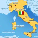
It became known that the Russian government has extended to the “northern territories” a new law on the free distribution of land to Russians. The law is aimed at the development of the Far Eastern region. The administration began accepting applications from those interested. Applications can be submitted for lands located in Kunashir and Iturup. Moreover, you can also get a free hectare on Shikotan, an island that, according to the Soviet-Japanese Declaration of 1956, should go to Japan after the signing of a peace treaty.
On the eve of President Putin's visit to Japan, which is scheduled for December, it is again becoming clear that Russia is strengthening its real control over the “northern territories”.
The new law came into force in May of this year. The Japanese government was monitoring whether Russia would apply the law to the “northern territories” on which Russian-Japanese territorial negotiations were to take place. This month, the Russian government introduced the law after seeking the wishes of residents of the Far Eastern region. Plots of land will be issued in Kunashir, Iturup and Shikotan.
Context
Is Russia ready to return the two islands?
Sankei Shimbun 10/12/2016How will Moscow and Tokyo divide the Kuril Islands?
Deutsche Welle 08/02/2016Kuril Islands Joint Management Project
Nihon Keizai 10/18/2016Will Shinzo Abe's dreams come true?
Nihon Keizai 03.10.2016The purpose of the law is to speed up the resettlement of Russians to the Far East and revitalize the region. Everyone will be provided with one hectare of empty land owned by the state or autonomous region free of charge. If the tenant uses it in accordance with the application, then after five years he will be able to take ownership of it. It is also possible to extend the lease. This month the state will accept applications only from residents of the Far East; in February next year it will begin accepting applications from all Russians.
Those interested can obtain plots located more than ten kilometers from settlements, whose population exceeds 50 thousand people. In the “northern territories” there are no such large settlements, so plots will be distributed there that are located close to places with well-established infrastructure.
According to residents of the Far East, it is possible to apply for sites that are within one kilometer of such central cities as Kurilsk (Iturup) and Yuzhno-Kurilsk (Kunashir).
The Putin administration plans to conduct territorial negotiations on the basis of the Soviet-Japanese Declaration, which talks about the transfer of two islands and at the same time allows for applications for land located on Shikotan. If land transfers proceed at a rapid pace, there is a danger that territorial negotiations will become more difficult due to population growth and other reasons.
In the Kuril Islands it is no longer possible to register a free hectare of property under the “Far Eastern Hectare” program, according to data from the website “On the Far East.ru”. Previously, the authorities themselves offered land plots for registration, including on Iturup and Shikotan.
The entire area of the Kuril Islands is reserved “for defense needs”; the opportunity to choose a free plot of land has disappeared. It is also impossible to buy and sell a plot of land.Just a few years ago, the program offered to choose a site on Iturup. Now it is impossible to take back “your” hectare in the Kuril Islands; the program only works in other areas of the Far Eastern region.
According to experts, the cost of land and natural resources on the islands is $240 billion. Based on the cost of land on the island. Hokkaido at $30-40 per meter 352 sq. km of Shikotan and Habomai cost $14 billion, and 5 thousand sq. km of Iturup, Kunashir, Habomai and Shikotan cost $200 billion.
In the Kunashir and Iturup ore clusters, gold reserves amount to 945 tons ($38 billion), silver 4.7 thousand tons ($2 billion), and there is also a deposit of the rare metal rhenium, which is used in the space and military industries.
Since the end of February, the territory of the Kuril Islands unexpectedly found itself closed as a “gray zone” in the Federal Information System (FIS) for the issuance of a free “Far Eastern hectare” - it became impossible to submit an application for registration for use of a plot of land on the ridge. Why strategically important islands, for the development of which Russia is funding a multibillion-dollar target program, were excluded from one of the mechanisms for the development of the Far East, EastRussia was looking into.
Suddenly Lost Islands
But until the end of February, applications for the provision of plots under the “Far Eastern hectare” program on the Kuril Islands were accepted by the system, and the Russians managed to submit just over 700 such requests.
On the scale of the entire Sakhalin region, this would seem to be not much - according to the Ministry of Eastern Development, more than 8.6 thousand applications were submitted throughout the region. The department, in response to a request from EastRussia regarding the closure from the issuance of a “hectare” of the Kuril Islands, clarified that only 8% of the Kuril Islands were submitted to the islands. total number Sakhalin applications, and throughout Sakhalin, as many as 40 thousand square meters are still available for free land. km of land.
The Kuril Islands, let us remind you, are 10.5 thousand square meters. km.
But not only this, but also two more nuances add urgency to the situation.
Firstly, the population of the Kuril Islands, according to Rosstat, as of January 1, 2016, is only 19,169 people. The population of the Kuril urban district (with its center in the city of Kurilsk) was 5934 people, the North Kuril district - 2501 people, the South Kuril district - 10734 people. Let's remember these numbers.
Secondly, according to data as of early March, the Kuril Islands were extremely popular among applicants from other constituent entities of the Russian Federation who wished to take land on Sakhalin. Of the 750 applications for Sakhalin “hectares” received at that time from other regions, almost a third, 276 applications, fell on the lands of the South Kuril urban district - the islands of Kunashir and Shikotan.
It turns out that almost three hundred residents of other constituent entities of the Russian Federation wanted to develop the Kuril land, and about 400 more residents of Sakhalin wanted to take “hectares” in their homeland - in order to develop, gain a foothold and stay. Applications for “Far Eastern hectares” on the islands, as is easy to calculate, were submitted by people in an amount equivalent to 6.5% of the permanent population of the South Kuril District and 3.5% of the population of all the Kuril Islands.
And no one will yet know how many more there would be.
At least until the Kuril Islands are opened for issuing “hectares” again.
Billions for tens of thousands
It is noteworthy that Russia has been developing the infrastructure of the Kuril Islands for several decades through the corresponding federal target program. The current version of the Federal Target Program is designed until 2025, the volume of investments under it is 69.6 billion rubles. The program provides financing for the construction of ships and helicopters to ensure communication with the Kuril Islands, social and energy infrastructure, communications, roads and modern housing. In fact, the Federal Target Program should double the local economy: it is assumed that the volume of tax collections from municipal budgets in the Kuril Islands will increase from 990 million rubles. in 2016 to 1.8 billion rubles. in 2025.
But most importantly, the authorities plan, people should flock to the Kuril Islands in the coming years. In 1989, the maximum population in their history lived on the islands of the ridge - 29.5 thousand people. The implementation of the Federal Target Program for the development of the Kuril Islands should increase the resident population by 2025 to 24,390 - by 27% from last year’s level.
700 applicants for the Kuril “hectares” could accomplish part of this task without government billions. But the fate of their applications is in question.
It should be noted that only one big problem stands in the way of the development of the Kuril Islands: Japan does not recognize Russia’s sovereignty over four southern islands The ridges are Iturup, Kunashir, Shikotan and Habomai with a total area of 5.1 thousand square meters. km. The diplomatic subtleties of the justification for the rights of Russia and Japan to these lands lead to the treaty of 1855 and subsequent wars. But precisely because of the unsettled status of the islands, many of them are still a border zone with enhanced control at entry and exit, and the Ministry of Defense is only increasing its presence in the Kuril Islands.
In 2017, the military department promised to station an entire division on the islands in addition to existing units armed with the Bastion and Bal coastal missile systems - they are capable of repelling an attack by ship and aircraft carrier strike groups. However, who and why will attack the Kuril Islands is not yet very clear. But the islands remain limitedly accessible to ordinary Russians - planes fly there and walk sea vessels, but the routes air transport it has to be subsidized from the regional budget, and the ships on the line are so outdated that the Sakhalin authorities decided to order new ones from the Khabarovsk Territory.
The authorities cannot yet clearly explain what is happening with the “Far Eastern hectare” in the Kuril Islands. “As for the Kuril Islands, we have to deal with the territories of the Ministry of Defense, these are forbidden territories, but otherwise we have no restrictions,” Deputy Prime Minister Yuri Trutnev said at the end of February during a visit to Sakhalin. And Sakhalin Governor Oleg Kozhemyako admitted: “people have a desire to build” in the Kuril Islands. “We are now reviewing these applications together with the Ministry of Defense, so that the selected areas do not violate their boundaries; some of the selected areas will have to be adjusted,” said the head of the region.
Uncertainty leads to exclusivity
The Ministry of Eastern Development explained to EastRussia that the zone of the Kuril Islands, in which plots will not be provided, is still being clarified. In particular, the issue of opening the territory of 13 settlements of the Kuril Islands for issuing a “hectare” is being considered. Each application submitted to the Kuril Islands is under control, and after determining the exact prohibition zone, it will be considered separately, the ministry assures.
The Information Policy Department of the Office of the Governor and Government of the Sakhalin Region responded to EastRussia’s request that “at present it is not possible to provide comments from regional authorities on the identified issues.” And the administration of the South Kuril District assured EastRussia that “there is no threat to the deterioration of activity on the registered and registered hectares, just as there is no reason for a drop in interest in these land plots».
The Ministry of Defense received EastRussia’s request, but has not yet provided any comments on it.
Some experts interviewed by EastRussia are more likely to justify the authorities who closed the Kuril Islands from issuing the “Far Eastern hectare.” “The Kuril Islands are a promising territory for the development of tourism, but the provision of land on the islands is complicated by geopolitical features and territorial disputes with Japan. Therefore, the issue of providing or not providing land for each specific region is a complex decision. It must be accepted by the organizers of the program, taking into account all possible risks,” says Tatyana Cheremnaya, head of the Center for Effective Territorial Development.
“Whatever the reason behind the Kuril Islands dropping out of the project, I don’t see any big reasons for concern: there are very few options for running a successful agricultural business on them. I will say even more, having lost the opportunity to get a hectare in the Kuril Islands, people only benefit - thereby fully gaining the opportunity to get a “hectare” in other places where it is much more profitable to do it,” says Vasily Koltashov, head of the Center for Economic Research at the Institute of Globalization and Social Movements .
But the head of the commission for monitoring the implementation of the Far Eastern Hectare project of the public council under the Ministry of Eastern Development, Mikhail Krivopal, emphasizes that it is necessary to inform potential and current recipients of the “hectare” about possible and existing plans to change the status of the land that is allocated for the “hectare”, and even more so has already been presented in the system - extremely important. “It is impossible to allow speculation and the emergence of far-fetched and, most often, unfounded reasons for refusal to provide land. Compliance with the principles of openness and transparency during the implementation of the project is a very simple and, in my opinion, the most effective way to level out and prevent possible discontent of the population,” he believes.
And Vasily Koltashov adds: “Of course, there is no clear evidence of this, but still in this whole incident of the Kuril Islands being excluded from the implementation of the “Far Eastern hectare” project, a kind of nod to Japan is seen. By demonstrating that Russia is not engaged in any development of the Kuril Islands and only joint interaction with Japan on their territory is being considered. Which, of course, is fundamentally wrong - Japan should, as expected, compete for activities in the Kuril Islands.”
Be that as it may, against the backdrop of the current uncertainty, the applicants themselves are canceling their requests for “Far Eastern hectares” in the Kuril Islands - as of March 10, the number of withdrawn applications for the South Kuril District amounted to 103 out of 601 received, the district administration reported. According to local authorities, people would like to engage in agriculture in the Kuril Islands, housing construction, development of recreation and tourism.
Whether they will succeed, only time will tell.
Applications for the “Far Eastern hectare” are received from citizens from all over the country. Yesterday corr. SakhalinMedia news agency got acquainted with the division of land on Sakhalin by studying the interactive map of the region on the FIS website "To the Far East". Today readers will be able to see where the applicants for free Kuril hectares “draw” their plots.
Let us remind you that the law on the “Far Eastern hectare” has been in force since June 1, 2016. From October 1, Sakhalin and Kuril residents could receive their plots. Since February 1 of this year, when land began to be issued not only to Far Easterners, but also to all citizens of the country, residents of the Sakhalin region began to submit applications much more actively.
At the beginning of the month, the Plenipotentiary Representative of the President of Russia in the Far Eastern Federal District Yuri Trutnev explained this phenomenon by saying that the Far Easterners were simply afraid that representatives of other regions would take away all their land.
Getting to know interactive map Sakhalin showed that the most delicious morsels on the island are southern lands. This is mainly the coast, where islanders love to come on vacation in the summer.
As for the Kuril Islands, here too people are happy to “tear off” a piece of land for themselves. Most applicants for free plots intend to engage in agricultural activities there.
Looking at the map on the FIS website "To the Far East" you can easily determine which island enjoys special attention and popularity. Kunashir became the undisputed leader. It was literally taken apart piece by piece. Areas located near the sea - the Kunashir coast - are especially well cut.
Kunashir: Yuzhno-Kurilsk. Photo: Print screen of the FIS site map "To the Far East"

Kunashir: Hot beach. Photo: Print screen of the FIS site map "To the Far East"

Kunashir: Sernovodsk. Photo: Print screen of the FIS site map "To the Far East"

Kunashir: Columnar. Photo: Print screen of the FIS site map "To the Far East"
In addition, applications have also been submitted for the lands of the islands of Shikotan and Iturup. However, the marked areas here are no longer located with the same density as in Kunashir, and their number is very small.

Shikotan: Krabozavodskoe. Photo: Print screen of the FIS site map "To the Far East"
On Shikotan, the villages of Malokurilskoye and Krabozavodskoye received attention.

Shikotan: Malokurilskoe. Photo: Print screen of the FIS site map "To the Far East"
On Iturup, plots were taken in the area of the village of Reidovo. There is Olya Bay and the Udobny roadstead. The recipients of the hectares decided to choose them.

Iturup: Reidovo. Photo: Print screen of the FIS site map "To the Far East"
In addition, more and more green rectangles are beginning to appear in the area of the city of Kurilsk on the same Iturup. There, the territory of the Kuril Bay coast is especially loved by Russians.

Iturup: Kurilsk. Photo: Print screen of the FIS site map "To the Far East"
It should be noted that some federal media reported that thanks to the distribution of free hectares, the Kuril Islands are experiencing a real revival.
We remind you that the entire region is divided into zones where it is possible and where it is not possible to take “Far Eastern hectares”. The areas where it is “impossible” are shaded in gray, and the areas where it is “possible” are shaded in white.
Areas already owned or leased are marked in red. Plots already given for use within the framework of the law on the “Far Eastern hectare” are marked in blue.
Using simple tools and a computer mouse, the potential recipient of a hectare draws the contours of his future plot in the desired location, with an area not exceeding 1 hectare for an individual application and up to 10 hectares for a collective application. After cutting a plot and subsequently sending an application for the provision of a plot through the website, its boundaries begin to be displayed on the map in the very place where the applicant drew it. They are indicated in green.
The program for allocating a “Far Eastern hectare” no longer applies to the Kuril Islands. According to the map posted on the nadalniyvostok.rf portal, all islands Kuril ridge(Sakhalin region) are marked as a “gray zone,” that is, as territories in which “a plot of land cannot be provided for free use.”
Moreover, just a few days ago the system accepted similar applications on the islands of the Kuril chain. The fate of already submitted but not executed applications that were completed before the restrictions were introduced remains unclear. Most likely, such applications will be cancelled.
As noted in an interview with an EastRussia correspondent local residents Kuril, the situation came as a complete surprise to them. Many have already submitted applications or were already ready to do so, but now their desire cannot be realized. At the same time, the interlocutors note that they would like to get the land they are entitled to on the islands: they cannot move by car to the neighboring region, and therefore find themselves in a discriminatory position in relation to other Far Easterners.
There is no official information yet about what the new restrictions are related to. According to unconfirmed data from a source in the Ministry of Eastern Development, the issuance of plots in the Southern and Northern Kuril regions could have been stopped at the request of the Ministry of Defense of the Russian Federation.
“This is not the first case in the practice of project implementation when the status of the land received by the applicants changes,” commented Mikhail Krivopal, a member of the Public Council of the Russian Ministry of Eastern Development, commenting on the situation. “This situation does not allow the use of the requested plots for the purposes of social or commercial development. It is necessary to exclude the slightest possibility of violation of rights project participants, therefore, all such changes in the conditions of land use should be as transparent and understandable as possible to all citizens, without exception, applying for a hectare in the Far East. I consider it important for the experts of the Public Council under the Ministry of Eastern Development to resolve such situations,” the expert notes.