Among the finds of the largest expedition in the history of Crimea are artifacts from the Stone Age, dishes from ancient times, and medieval weapons.
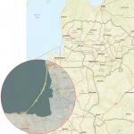
The Crimean new-building expedition of the Institute of Archeology of the Russian Academy of Sciences, which began last spring, is completing its work in the eastern part of the peninsula. During this time, in the area along the Tavrida highway under construction from Simferopol to Kerch, experts examined more than 60 monuments - from the Mesolithic to the 19th century.
“This is the largest archaeological excavation in the history of Crimea. We explored an almost 300-kilometer “historical-cultural section” that goes back 10 thousand years. Anthropologists, paleozoologists, soil scientists, restorers, scientists from Crimea, Novosibirsk, St. Petersburg, and the Krasnodar Territory worked with us,” said the head of the expedition, Doctor of Historical Sciences Sergei Vnukov.
He also emphasized that a lot of work remains to be done on analyzing the collected material, but now it is already possible to sum up the preliminary results of the work. Upon completion of the research and publication of the results, all finds - several thousand artifacts - will be transferred to the museums of Crimea.
For the first time, leading Russian archaeological institutions from various regions participated in a major project to preserve monuments: Institute of Archeology RAS (Moscow), Institute of the History of Material Culture RAS (St. Petersburg), Institute of Archeology and Ethnography SB RAS (Novosibirsk), Historical and Archaeological Museum-Reserve “Scythian Naples” (Simferopol), the Institute of Archeology of Crimea (Simferopol), as well as archaeological organizations of the Krasnodar Territory. The interaction of different scientific centers and archaeologists who previously worked in the Black Sea region made it possible to carry out large-scale field work in a short time.
The most ancient monument that the expedition explored was the Yablochnoye 1 site in the Belogorsky district. Stone tools and preparations for them were found here: cores, flakes, blades, scrapers, scrapers, and a chisel. Finds indicate that there were camps of Stone Age hunter-gatherers here. The features of the tools make it possible to date the site to the Mesolithic and Neolithic eras, that is, the 9th–4th millennia BC.
Fourteen burial mounds explored by the expedition date back to the Bronze Age. In those days, the Crimean steppes and foothills were inhabited by nomads who buried their dead in mounds on their sides with their knees drawn up. The earliest such mounds were built by the Yamnaya (second half of the 3rd - early 2nd millennium BC) and Kemi-Oba (late 3rd - first half of the 2nd millennium BC) archaeological cultures. Burials of the Kemi-Oba culture were made in stone boxes with interior walls painted with ocher. The buried were accompanied by molded vessels, stone and bone items.
During the Late Bronze Age, complex stone structures appeared in the mounds. The most striking example was mound No. 3 of the “Fontan 1” mound group. Here, before the first burial, they built a low earthen platform, which was lined with stones along the perimeter. Adjoining it from the south was a structure made of large stone blocks in the shape of the letter “P”. In the center of the site, under the slabs, a child was buried, with an ornamented molded vessel placed next to it. Later, a square fence made of the same massive blocks was erected around the central burial. In subsequent periods, several more burials were made in the mound.
Top view of the stone structures of the Bronze Age mound, the burial mound "Fountain 1".
Eleven mounds and more than ten inlet burials in mounds of earlier times date back to the early Iron Age (Kizil-Koba and Scythian cultures – 9th–4th centuries BC). In most cases, these are burials in simple rectangular pits, accompanied by molded vessels. Bronze arrowheads, single iron objects and jewelry are also found in Scythian burials. In one burial where a warrior was buried, they found a Greek amphora with a mark.

Mound of Sary-Su of the Scythian time. Horse bones and a Heraclean amphora in the central burial.
Antiquity
Ancient settlements in the excavation zone were discovered only on the Kerch Peninsula within the borders of the Bosporan Kingdom. These are mainly rural settlements of the Hellenistic period of the 4th–3rd centuries BC. e. In addition, experts examined the site of the “11th kilometer” settlement of the 1st century BC. e. – III century AD e., where a large number of artifacts, including coins, were found. Excavations are also carried out on all defensive ramparts of the Kerch Peninsula: Beskrovny, Akkosov (Uzunlar), Akmonai.
For the first time, detailed studies were carried out in the “Hospital” and “Tsementnaya Slobodka” mounds in Kerch. Their crypts were destroyed and robbed in ancient times.

Red-figured black-glazed pelica, third quarter of the 4th century. from a burial in the Hospital mound. 
Red-figured black-gloss ask from the feast complex of the Hospital mound. 
Red lacquer cup, barbotin, 1st century. BC. from a burial in mound 4, Tsementnaya Slobodka burial ground 1.
Ten kilometers west of Kerch, archaeologists studied two mounds of the Alexander Rocks group. Two burial grounds of the 1st–2nd centuries AD were found here, in which 213 burials were discovered.
Red clay and red varnish bowls and jugs were found in the burials. Animal bones are often found in bowls. There are frequent finds of small iron knives and whetstones, bronze brooches and glass bottles, and beads. 
Gutus (dispensing vessel) red varnish from the Roman burial ground “Alexandrovskie Rocks 1”.
Middle Ages
The earliest medieval monuments along the Taurida route are represented by inlet burials into ancient mounds of the 11th–13th centuries. One of the most interesting is the burial of a Polovtsian nomadic warrior in mound 1 of group of fourteen mounds in the Belogorsk region. The warrior was buried with iron chain mail, a chain mail helmet, a leather quiver with arrows, an iron saber, a stump of a twisted silver hryvnia, an amphora, and a bronze cauldron with an iron bow.
Two settlements date back to the era of the Golden Horde: “Kosh-Kuyu” and “Pearl-1”. During the study of Zhemchuzhina-1, six completely preserved adobe stoves with air ducts made of ceramic pipes were found. Remains of grain were found in a layer of ash that filled one of the furnaces. Copper coins, elements of horse harness, and fragments of knives were found at the settlement.

Settlement "Pearl-1". Top view of the stove of the Golden Horde period.
Among the ceramics found here, ceremonial dishes stand out: glazed multi-colored ornamented bowls of local production and imported kashin (kashin is a white porous ceramic mass) bowls of the 13th – first half of the 14th centuries. Particularly interesting is the glass vessel painted with colored enamels; its analogues can be found among Near Eastern vessels of the second half of the 13th–14th centuries. 
Glazed and kashina tableware from the Golden Horde period from the settlement"Pearl-1".
Settlements of the late Middle Ages and modern times are represented by six monuments. In two settlements, only limestone floors with fireplaces and underground pits were preserved from the buildings; the buildings themselves were probably wooden.
At the end of the 18th–19th centuries, masonry made of processed stones on clay appeared. Finds from this time include Turkish and Russian coins, smoking pipes, simple jewelry and copper items. Technological traditions in ceramic products are undergoing some changes, but many forms of vessels known back in the Golden Horde period are preserved.
An interesting stone “cistern pool” with a well in the center was excavated at the settlement “Leninskoe 7” (19th century village of Argin). Apparently this was a public building.

Settlement of Argin. General view of the “cistern cellar” of the 19th century.
S.Yu. Vnukov, I.V. Rukavishnikova, A.N. Khokhlov, K.I. Panchenko (all – Moscow), A.M. Mikhailov (Kerch), Yu.P. Zaitsev (Simferopol), P.I. Shulga (Novosibirsk), E.I. Narozhny (Armavir).
Archaeological sites (A. A. Shchepinsky)
This term refers to ancient defensive residential, economic, religious and funerary structures, rock carvings (hieroglyphs), tools, weapons, utensils and many other remnants of former human life found on the ground, underground, in water, etc. In our country they are the property of the people and are protected by the state. Their searches and excavations are carried out only by archaeologists with special permissions. Archaeological monuments make it possible to read the most ancient pages of human history and restore events that took place many millennia before the advent of writing. Thus, according to very meager written evidence, the oldest inhabitants of Crimea can be judged no more than 2500-2700 years ago, and according to archaeological sources no less than 250 thousand years.
In Crimea, archaeological sites are distributed everywhere: on the southern coast, in the mountains, in the steppes, in the Sivash region, on the Kerch and Tarkhankut peninsulas. The beginning of their study dates back to the end of the 18th-19th centuries. and is associated with the names of such prominent researchers as P. S. Pallas, P. P. Sumarokov, P. A. Dubrux, A. I. Stempkovsky, F. Dubois de Montpereux, P. I. Keppon, G. A. Karaulov , K. S. Merezhkovsky and others.
Archaeological monuments are usually divided into historical eras, periods, stages, cultures, etc. In this sequence, starting with the most ancient eras, the main archaeological monuments of Crimea are considered.
Early Paleolithic. Represented by materials from the Acheulian (from 300-250 to 100 thousand years ago) and Mousterian times (100-40 thousand years ago). Acheulian workshop sites are located on high watershed ridges in the vicinity of Bakhchisarai (Shary I-III, Bodrak I-III, Bakla) and Belogorsk (Tsvetochnoye, Karakush, etc.). These sites, based on the characteristics of the flint tools found on them (choppers, scrapers, etc.), should be classified as a special Acheulean region in the south of the European part of the USSR.
The Mousterian era is better studied, represented by no less than 70 monuments, which, according to their location, are divided into two groups - cave type, i.e. located in natural shelters protected by rocks (grottoes, canopies), and open type - located on river terraces, yaylakh, sea coast. Based on the functional purpose, nature and number of finds, all Mousterian monuments are divided into five groups: 1) long-term settlements - Kiik-Koba, Prolom, Zaskalpaya I-IX, Ak-Kaya, Volchiy Grog, Chokurcha, Kabazi I, Shaitan-Koba, Staroselye and others; 2) short-term, seasonal hunting camps (camps) - Kara-Kigai, Okup, Kiyatskaya drought, Pervomaiskoye, Adzhi-Koba, Chagorak-Koba, Sary-Kaya, Rodnikovoe, Krasnaya, Ulu-Uzen, Kholodnaya Balka II, etc.; 3) individual locations - Novy Svet, Karabi-yayla, Ai-Petri, Prisyazhnaya, Osipova gully and many others; 4) workshops - Skalistoe, Bakla; 5) religious, ritual places - the site at the entrance to Chokurchu, Kholodnaya Balka.
In addition to numerous flint items and bones of animals that were hunted by humans, the remains of the skeletal remains of eight Neanderthals, carriers of the Mousterian culture, were discovered at four Mousterian settlements - Kiik-Koba, Staroselye, Zaskalyaaya V and VI. In the USSR, not counting Crimea, only one case is known of the discovery of a Neanderthal skeleton - the Teshik-Tash grotto in Uzbekistan.
Late Paleolithic (40-10 thousand years ago). Cave sites belong to this era (Adzhi-Koba on Karabi-yayle, Buran-Kaya in the valley of the Burulchi river; the upper layer of Zaskalyuy IX near Belogorsk; Shaitan-Koba II in the valley of the Bodrak river; Kachinsky canopy on the Kacha river; Suren I in the valley of the Belbek river), and open-type sites (Malinovka - in the valley of the Alma river, Donskoye on the Burulche river). The most interesting materials were provided by excavations in Sureni I, where three cultural horizons were identified that make it possible to characterize all stages of the Late Paleolithic (Aurignacian, Solutre, Slow).
Mesolithic (10-8 thousand years ago). At least 15 cave and 10 open sites date back to this period. The Mesolithic is most clearly represented by cave sites in the southwestern part of Crimea (Shan-Koba, Murzak-Koba, Fatma-Koba, Kara-Koba, Vodopadny Grotto, Zamil-Koba I and II, Alimov Canopy, Tash-Air I). In the northeastern part of the peninsula, only one site is known (Buran-Kaya). The sites of the second group - open type - were studied on the yailas (Chatyrdagskaya, Aypetrinskaya, Dolgorukovskaya) and on the Kerch Peninsula (Frontovoye I and II, Koi-Asan, Alekseevka I, Lugovoe I, Leninskoye, etc.). Many researchers also attribute the lower layer of the Kukrek site in the upper reaches of the river valley to the Mesolithic. Zooey. Interesting sites of this time were discovered on the southern coast in the Laspi tract. Cave monuments are permanent settlements, and the Kerch and Yaylip sites are spring-summer-autumn camps of hunters and gatherers. Apparently, the southern coastal sites associated with coastal marine fishing are also seasonal.
Within Ukraine, the monuments of this time constitute a special Crimean Mesolithic group. Based on the characteristics of the inventory, two cultures are distinguished in the Mesolithic of Crimea - the early, Shankobin (Azilian) and the late, Murzak-Kobin (Tardenoise). The first is characterized by massive incisors, scrapers, knife-like plates and segments, while the second is characterized by the geometric shape of the tool, as well as the complexity of their processing technology.
In the Murzak-Koba cave, a pair burial was discovered - a man (40-50 years old) and a woman (20-25 years old), in the Fatma-Koba cave - a woman (40 years old), in the Zamil-Koba cave - fragments of a skull. All these are the remains of Cro-Magnons.
Neolithic (8-6 thousand years ago, or about 5500-3200 BC) represented by materials from at least 50 settlements and sites in the mountainous Crimea - At-Bash, Balin-Kosh, Yusupov basin, Ai-Petri, Eklizi-Burun, Kizil-Koba; in the southwest - Zamil-Koba II, Tash-Air I, Kaya-Arasy, Shan-Koba; central - Konstantinovna, Denisovka; in the northeast - Kukrek; steppe - Ishun, Dolinka, Martynovna; on the Kerch Peninsula - Frontovoye II, Lugovoe, Tasunovo, Leninskoye, Koi-Asan, etc. One collective trench-type burial ground is also known (the village of Dolinka). The inventory is varied: numerous flint products of microlithic appearance - cores, scrapers, burins, trapezoids, segments, piercings, tips, as well as fragments of pointed-bottomed molded ceramics. Among this ancient pottery, fragments of thin-walled vessels with a polished brownish-gray surface stand out. So-called flint trapezoids with a planed back appear - a feature typical of the Crimean Neolithic. Inserts of the Kukrek type, originally discovered only in the wall and north-eastern part of Crimea (Kukrek), are well represented.
Chalcolithic (III millennium BC). The most striking monuments are the numerous mounds of the plain part of Crimea, the Sivash region, the Kerch Peninsula, Tarkhankut and the foothills region. The most famous are the Eneolithic mounds of Kemi-Oba near Belogorsk, Kurban Bayram near Krasnoperekopsk, Zolotoy near Simferopol, Kazanka and Endekli-Oba near Bakhchisarai and many others.
Settlements and sites were mostly open; they gravitated towards fertile river valleys. On the sea coast - from the Black Sea in the west to Sudak in the east - sites of the "shell heap" type were discovered. In the Chalcolithic, along with flint products and ceramics, there are products made of copper and copper-arsenic alloy. Two Eneolithic cultures are known in Crimea: the Kemi-Oba and the ancient Yamnaya. The first of them was first identified in Crimea after excavations of the Kemi-Oba mound near Belogorsk. Nowadays, in the south of the European part of the USSR there is a vast Kemi-Oba cultural and historical region, consisting of no less than three local variants - Crimean, Azov and North Black Sea.
The ancient Yamnaya culture of Crimea also belongs to a special cultural and historical area. Unique monuments of the Kemi-Oba culture include the rock painting of Tash-Air I, anthropomorphic steles from Kazanki, Ak-Chokrak and Verkhorechye, as well as a stele with a cult plowing scene from Bakhchi-Eli near Simferopol.
Bronze Age (II - early 1st millennium BC). In Crimea, it is represented by three cultures (catacomb culture, multi-roller ceramics culture and timber frame culture). The southern border of the distribution of these crops is the second interridge depression (the strip of foothills). In the mountainous Crimea, few Bronze Age monuments are known and they have not been sufficiently studied. In the sea coast zone from the Heraclean to the Kerch Peninsula there are settlements of the second half of the 2nd millennium BC. e., which can conditionally be identified as a special coastal culture (“coastal variant of the late Catacombs”).
In Crimea, the majority of Bronze Age burials are embedded in the mounds of Eneolithic mounds. In human everyday life, along with stone products, bronze products are widely used. Stone residential and outbuildings are being built in settlements.
Early Iron Age (8th century BC - 4th century AD). The earliest monuments of this time: 1) Cimmerian (mound near the village of Zolny on the outskirts of Simferopol, mounds of the steppe Crimea, Alimovskoe settlement near Simferopol, cyclopean structures of the Golden Mound near Kerch, etc.); 2) Kigil-Koba settlements (Simferopol, Kholodnaya Balka, Neyzats, Tash-Dzhargan II, Druzhnoe); cave sanctuaries (Kizil-Koba, Yeni-Sala, MAN, Snake Cave); burials under the mounds (Simferopol Reservoir, Maryino, Kolchugino, Novonavlovka, Vodopoinoe, etc.); 3); Havre settlements and settlements (Tash-Dzhargan I, Alimov canopy, Mramornoe, etc.); burial stone boxes (Kizil-Tash, Alanka, Karasu-Bashi, Karla-Kaya Chuyuncha, Druzhnoe II and III, Uch-Bash, Tash-Dzhargan I, Bashtanovka, Takluk, Malaba, Koramen, Tokha-Dakhir, Gaspra, Koshka and many other).
Cimmerian and Kizil-Koba monuments are known throughout the entire Crimea and beyond, Taurus - only in the mountainous part and on the southern coast.
The next group consists of Scythian monuments (VII century BC - III century AD). The earliest of them are burials in the Temir-Gora, Kul-Oba, Golden Kurgan, Three Brothers on the Kerch Peninsula, Golden Kurgan and Talaevskny near Simferopol and others. Undisputed early Scythian settlements of the 7th-6th centuries. BC e. not identified in Crimea, but on the Kerch Peninsula near the current villages of Sazonovka, Andreevka, Maryevka, rural settlements of the 6th-5th centuries were discovered. BC e., which arose, as researchers believe, due to the settlement of nomadic Scythian tribes. However, they cannot be considered typically Scythian, since in their culture the material of ancient artisans with pronounced Greek traditions is widely represented. All these settlements were located on the royal or state land of the Bosnorian kingdom, therefore, in close dependence on the latter.
Settlements of the 5th-3rd centuries belong to the same circle of monuments. BC e. - Marfovka, Zolotoye, Slyusarsvo, Sokolskoo, Mysovoye, Ogonki, Zamorskoye, Frontovoye and others on the Kerch Peninsula. In addition to local stucco and pottery antique ceramics and other implements, rocky or clay dwellings, grain pits, etc., somewhat deepened into the ground, were discovered here.
At the end of the IV-III centuries. BC e.-III century n. e. In the Crimea, the Late Scythian state was taking shape, the ruins of whose capital - Scythian Naples - are located in the south-eastern part of Simferopol. The remains of a defensive wall with the central city gate, the mausoleum of the Scythian king Skilur, grain pits, the walls of a public building, a rich residential building with a semi-basement, buildings with frescoes, unique painted crypts carved into the rock, etc. have been preserved.
Other Late Scythian settlements, shelters and settlements are also known - Kermen-Kyr, Zalesye, Tash-Dzhargan, Dobroe, Zavetnoye, Zayache, Beki-Eli in the foothills. Chaika, Airchi, Belyaus, Dzhan-Baba, Karadzha, Yuzhno-Donuzlavskoye, Tarpanchi and others on Tarkhankut. Many of them have been discovered in recent years in northeastern Crimea.
The ancient monuments of Crimea are world famous. Among them, Chersonesos (within the boundaries of modern Sevastopol) occupies a special place, which existed for about two thousand years (from the last quarter of the 5th century BC to the first half of the 15th century AD). Powerful fortress walls and towers, city gate of the 3rd century BC e., the remains of an ancient theater (III-II centuries BC - IV century AD), streets and neighborhoods with courtyards, wells, residential and public buildings. The tower of Zeno, the cruciform temple with a mosaic floor, the basilicas of the 6th-10th centuries, the baptismal sanctuary of the 6th-7th centuries attract attention. and much more. To the south of Chersonese on the Heraclean Peninsula there are numerous Chersonese land plots with the remains of rural estates. This is the chora (district) of the ancient city.
It is believed that the agricultural district of the Chersonesus state stretches for many kilometers along the northwestern coast of Crimea. In addition to Kerkinitida (emerged at the turn of the 6th-5th centuries BC on the site of present-day Evpatoria), there are Kalos-Limen (now the town of Chernomorskoe), as well as a number of fortifications (Chaika, Belyaus, Kulchuk, Karadzha , Masliny), fortified settlements (Tarpanchi, Dzhan-Baba), non-fortified settlements (Panskoye I, Mayak, Yuzhpo-Dopuzlavskoye, Mezhvodnoye, Zapadno-Donuzlavskoye), isolated rural estates (Cape Oirat, Akchi-Saray, Okunevka I, Panskoye III , Grottoes) and many other monuments of the late IV - early II centuries. BC e., owing their origin to the ancient Greeks and late Scythians.
No later than the 6th century. BC e. (and perhaps in the 7th century BC) on the site of the pyneshpei of Kerch, the ancient Greeks founded Panticapaeum - the capital of the Bosporan kingdom. Its fortified part - the religious and political center - was located on the top of Mount Mithridates. Fragments of columns and statues, ruins of residential and commercial buildings, and craft workshops were found here. The city had a double line of defensive walls with towers up to 7-10 m high and up to 2.5 m thick. The remains of the prytaneum have been preserved - the houses of the city authorities, 30 m long and 15 m wide; the courtyard adjacent to the building was surrounded by a Doric colonnade.
A few kilometers from Panticapaeum, on the rocky cape of the northern part of the bay, is another Bosporan city, Myrmekium (mid-6th century BC - 3rd century AD), at one time well fortified. In the central part of Myrmekia, remains of dwellings and the walls of a large public building of the 3rd century have been preserved. before i. o., fish-salting baths, wineries of the 3rd century. BC e. In the rocks above the sea there were crypts, in one of which stood a sarcophagus decorated with sculptural reliefs, now kept in the State Hermitage.
Near Panticapaeum, mostly on the shores of the Kerch Strait, there are several more ancient settlements: Parthenium, Porthmium (with an acropolis on the top of a hill; it was once surrounded by powerful defensive walls), Ilurat (a fortified city, the ruins of defensive walls and towers, city blocks with residential buildings, drains), Tchritaka (remains of defensive walls and a rampart have been identified, a house of the 6th century BC, a building of the early medieval period - a Christian temple of the 6th century AD), Nymphaeum (remains of an ancient defensive wall, stone buildings have survived VI-V centuries BC, sanctuary of Demeter, outbuildings). 45 km south of Kerch, at the foot of Mount Opuk, is the settlement of Cimmeria (VI century BC - III century AD), once a large trading port of the Boepor kingdom. To the west of the settlement is the Uzunlar Lake with the adjacent Uzunlar (Akkoz) ditch and rampart. This powerful defensive structure, erected to protect the Boepor state from nomads, crosses the Kerch Peninsula from north to south, from the Azov Sea to the Black Sea.
Theodosia also dates back to ancient times (mid-6th century BC), which at first was a serious competitor to Panticapaeum, and from about 380 BC. e. became the westernmost city of the Boepor kingdom.
Works of Boepor art enjoy worldwide fame: the crypt of Demeter, tombstone reliefs, architectural monuments - the Tsarsky and Melek-Chesme mounds, wonderful examples of ancient sculpture.
There are relatively few expressive monuments of Sarmatian culture in Crimea. These are mainly individual burial mounds, including the Nogaichinsky mound, which contained a rich burial of a Sarmatian queen or priestess. However, the influence of Sarmatian culture can be traced in the inventory, funeral rites, etc. of the Late Scythian, Bosporan and other monuments of Crimea.
Middle Ages in the steppe Crimea it is represented mainly by nomadic burials in the mounds of ancient mounds (Sary-Bulat, Portovoye, Martynovna, etc.), the remains of temporary sites, small settlements, etc. A special place among the steppe antiquities is occupied by the Polovtsian “stone women” who stood in sanctuaries on the tops of mounds (Vodopoinoye, Chokrak, Voskhod), and are currently stored in museums.
In the rest of Crimea, among the most striking and expressive monuments of the 5th-7th centuries, in addition to Khersoyes, the ruins of Aluston (now Alushta) and Gorzuvit (Gurzuf) - strategically important Byzantine fortresses on the Southern Bank - stand out. The same fortification of the 6th century. known in Sudak at the foot of the Fortress Mountain.
In the southwestern Crimea, in medieval times, “cave cities” appeared - Kalamita (Inkerman), Eski-Kermen, Suren, Kachi-Kalyon, Tepe-Kermen, Kyz-Kermen, Chufut-Kale, Bakla, etc. They are located on picturesque rocks , dominating mountain gorges and valleys. Some of them are large cities with an area of up to 10-15 hectares (Chufut-Kale, Eski-Kermen, Kyz-Kermen), others are smaller, only 1-2 hectares (Tepe-Kermen, Surensky fortification).
Bakla, the northernmost “cave city”, arose earlier than others - in the 4th century. n. e. It is located between the Alma and Bodrak rivers, near the village. Rocky. Numerous utility rooms, grain pits, casemates, tombs, and temples were carved into the cliffs. On the plateau are the remains of a fortress (walls and towers), residential and utility buildings, and religious buildings.
Chufut-Kale(on the southeastern outskirts of Bakhchisaray) - a popular “cave city”, with well-preserved above-ground buildings, defensive structures, etc.
Tepe-Kerman, near Bakhchisarai, is a feudal castle or fortified monastery, with numerous “casemates” carved into the rock, a cave church of the 8th-9th centuries. and ruins of stone structures.
Kachi-Kalyon- settlement and monastery, on the banks of the Kacha near the village. Preugtselnogo. In the cliffs and individual boulders there are monastery premises, monks' cells, and a cave temple. Lots of tarapans (grapes and vilen).
Mangup, or Mangup-Kale, is the largest and most spectacular “cave city”. In the XIV-XV centuries. - the capital of the Principality of Theodoro. The citadel is well preserved, there are many artificial caves and above-ground buildings.
Eski-Kermen, 7 km from Mangup, is a medieval city with cave temples (two have preserved frescoes) and other structures, both carved into the rocks and above ground.
Researchers believe that the emergence of the “cave cities” of Crimea was caused by the economic and political situation that developed in southwestern Taurica after the Hun invasion, and indicates the emergence of a feudal society. Many of them died under the attacks of later nomads, a smaller part (Mangup, some monasteries) continued to exist.
At the passes of the Main Mountain Range, apparently at the same time, stone walls were built. They are known in the Chigsnitra area on Karabi-yayla (above the village of Privetny), Karatau, Tash-Khabakh, between Northern and Southern Demerdzhi and in other places. According to a number of researchers, the walls were built on the orders of the Byzantine emperor Justinian I. They ceased to exist in the 8th-9th centuries, possibly as a result of the Khazar invasion.
The Genoese fortress in Feodosia (medieval Kafa) is well preserved. Particularly noticeable are the tower of Clement VI (1348), above the former Quarantine Settlement, and the tower of St. Constantine (1382-1448) in the central part of the city.
The most interesting architectural and archaeological monument of Crimea is the fortress in the present city of Sudak (Sugdeya among the Greeks, Surozh among the Russians, Soldaya among the Genoese). This is a large fortified settlement, surrounded by two tiers of defensive structures - walls and towers. The early construction period of this monument dates back to Byzantine times, the later, main period - to the Genoese (XIV-XV centuries), therefore the fortress is usually called Genoese.
An open settlement on Tepsen Hill in the town of Planerskoe dates back to medieval times. Settlements of the 8th-9th centuries. discovered on the coast between Sudak and Alushta (Vorop, Choban-Kule, Kanakskaya gully).
Among the fortifications on the southern coast of Crimea we will name: Kastel near Alushta, Krestovaya above Alupka, Psar-Kaya near Gaspra, Uchan-Suisar near Yalta, B"shok-GTear near the village of Opolznevoy, Pakhkal-Kaya, Seraus. One of them is a large fortification , other sentinel points, etc.
Let us also note such medieval monuments of the upper reaches of the Kachn and Belbek rivers as Basman, Boyka, Syyuryu-Kaya, Sandyk-Kaya. Here you can see the ruins of defensive walls, residential and outbuildings, ruins of towers, stone fences, terraces, remains of roads, buildings, estates, grain pits, crypts, tombstones, chapels, etc.
The high level of culture of the medieval Armenian colony in eastern Crimea can be judged by the remains of the remarkable Surb-Khach monastery (founded in the 14th century) near Old Crimea. The monastery has preserved paintings from the 14th-15th centuries. In Old Crimea there are the ruins of a large Muslim religious school (madrassa) with the adjacent mosque of Uzbek Khan (built in 1314). Nearby is the Kurgaum-Jami mosque (late (XIV century).
An interesting monument is a mosque from the 14th century. Eski-Saray, it is located near the village. Pionerskogo near Simferopol.
Among the late medieval monuments, the former Khan's palace in Bakhchisarai is especially popular. The ruins of the Turkish fortress Yenikale (“new fortress”), 14.5 km northeast of Kerch, as well as the Turkish fortress at the base of the Arabat Spit, date back to the same period in the history of Crimea. On the northern borders of the peninsula, but a narrow isthmus of land between the Karkinitsky Bay of the Black Sea and Sivash, there is the famous Perekop ditch and rampart (obviously arose in Scythian times) with the remains of another Tatar-Turkish fortification - Or-Kapu. Interesting late medieval monuments of Evpatoria: the Juma-Jami mosque; tekne of dervishes (Muslim monastery), the only such monument in Crimea; Turkish bath, medieval Karaite buildings - temples, residential buildings.
Other late medieval monuments are also known in Crimea. But these are no longer so much archaeological monuments as historical and architectural monuments.
To the Crimean archaeological sources of medieval times, as noted by A.I. Dombrovsky, belong to different times, not identical in terms of fortification, and therefore functionally different fortifications. The remains of numerous settlements and burial grounds, traces of past agricultural terracing of long-forested mountain slopes, terrace crepides and ancient paths hidden in the mountains, abandoned pottery water pipelines, irrigation ditches that are now not in use, fountains, wells, medieval quarries, ore smelters and pottery kilns have not yet been sufficiently explored. etc.
The sacristan population of the peninsula, of course, could not coexist peacefully for long periods of time. Intercommunal conflicts, in particular, are evidenced by numerous - different, although synchronous - defense systems: shelters near open settlements are fortified, but not populated in peacetime; villages surrounded by walls; places of temporary stay in mountain caves. There are also simple, small-sized dwellings standing next to each other on mountain heights; Villages with houses in the form of small towers were planned in a hundred-like manner, which turned the farmer's estate into a kind of fortress. The strata of cultural layers and the stratigraphy of construction remains indicate long-term and constant use by the population of all points of the above categories.
The choice of places to live and differences in lifestyle are determined primarily by the age-related habit of certain newcomer groups of the population to certain forms of economic activity, which could develop in specific conditions of natural habitat. This includes transhumance in the mountains, hunting combined with beekeeping, collecting gifts of nature, and “chairne” farming on small plots of land cleared of forest, farming in valleys and gardening on low watersheds, viticulture on the southern slopes of the mountains and fishing. , small rural crafts and the like.
The study of archaeological monuments left by bearers of different archaeological cultures should begin with the Byzantine - VIII-X centuries. their appearance was facilitated by mass migration during the period of iconoclasm. At this time, slab burial grounds appeared, in the area of which burials were carried out according to Christian custom - stretched out on the back, head to the west; Pectoral crosses were found in some graves. At the same time, rural settlements and fortified monasteries with materials of provincial Byzantine culture appeared throughout the territory of Southern Crimea (round-bottomed red clay amphoras, Byzantine bilogged dishes - painted oinochoia and flasks, small flat-bottomed pithoi, various pots). Later, the forms of amphorae change.
The area of settlements and the number of buildings in them are quite significant. On the ground side, the settlements were surrounded by fences about 3 m wide, but on the territory itself the structures were placed haphazardly. The most famous attraction of that time is Ayu-Dag - a village located on the top of a forested mountain. Two types of houses were built here - single-chamber and pentatist houses, the sizes of which were twice the previous ones. There was a temple in the center of the settlement.
Simultaneously with rural, small-sized, single-nave basilicas, in the era of iconoclasm, three-nave and three-apse basilicas of much larger sizes appeared. The activity of monastic immigration also spread in the mountainous regions, where a significant group of cave monasteries appeared, the nature of the development close to the so-called “cave cities” (Fig. 27).
Such cities are called a unique group of monuments (fortifications, monasteries, villages) located in the foothills of the peninsula. Their characteristic feature is various premises carved into the rock for economic, military, residential and religious purposes. The remains of above-ground buildings are now covered with soil and vegetation. Fortified settlements often reached significant sizes (about 10 hectares), as was typical for those times. Part of their area was undeveloped and was probably intended to protect the surrounding rural population during enemy attacks or trades.
Rice. 27. "Cave city" Chufut-Kale near Bakhchisarai
Two of them - Eski-Kermen and Chufut-Kale - located near Bakhchisarai. The first arose in the V-VI centuries. and existed until the end of the 13th century. The defensive walls, made of stone, were about 2 m thick. They were adjacent to towers carved into rocky ledges. The city had many stone buildings and about 400 caves, as well as church buildings. During the excavations, streets and grain pits carved into the rock, a deep well, a water supply system and the remains of craft workshops were discovered. The population was engaged in agriculture, cattle breeding, viticulture, crafts and trade.
One of the most “cave cities” was Chufut-Kale. It is surrounded by impressive stone walls with arched gates. It arose, like others, in the V-VI centuries. Many cave complexes, a deep well and other structures were discovered on its territory. Later, the Tatars ruled over a mint and a prison for prisoners and hostages, and became a center of crafts and trade. A large burial ground was discovered not far from the city.
The settlements of the early Bulgarians of the 7th-10th centuries, discovered in different parts of the peninsula, can be divided into two chronological groups, the “watershed” between which was the middle of the 8th century. The earliest and most typical settlements include the Tau-Kipchak settlements, where buildings with stone walls were placed in five “kushama”. Each of them included similar structures, grouped two or three together. The distance between individual groups reached 10-25 m. Inside, only one room had a fireplace (that is, it was residential), the rest performed household functions.
The Khazaro-Bulgarians, having come to Taurica, brought with them a characteristic type of housing - a half-dugout with a domed roof. But, having become acquainted with developed stone construction, they began to build above-ground structures. Dry masonry of the walls in a herringbone pattern was also characteristic of this circle of monuments. The ceramic complex consisted of local and imported amphoras, pots and cups of various types. Modeled ceramics in their mass are made on a potter's wheel. A large number of agricultural implements were discovered. During the second of the mentioned periods, material culture in its main indicators did not undergo changes. Early Bulgarian culture disappeared in the middle of the 10th century. due to the Khazar-Byzantine wars. Later, a new ethnocultural community began to form here.
In the first centuries of the 2nd millennium AD, most of the settlements of Taurica were characterized by the following features: buildings, as a rule, are located on rocky or very steep terrain, unsuitable for cultivation. The floodplain of the river or the flat part of the irrigation valley is used only for gardening or crops. This feature is also characteristic of the Baydar Valley, where settlements located around it on the mountain spurs have been recorded. Other types of mountain settlements are also known, the residential and economic buildings of which were built directly on earthen terraces with retaining walls or fields divided into sections by stone fences.
Among the settlements of the XII-XIV centuries. There are three main types of planning, which are well documented in the Laspi tract near Yalta. First of all, this is the village of Haspio with a porous structure, consisting of more than 30 terraces that descended to the sea. They were fortified with stone crepides, on which stood the walls dividing the terraces. A residential tower, utility rooms, and a barn for small livestock adjoined the walls of each such center. All settlements used water supplied from one water supply system, built from pottery pipes (Fig. 28).
Later, another settlement appeared - Shaburla. Relatively regular rows of buildings here were located on long terraces. These structures were built at a considerable distance from each other. Large pithoi were dug in to store water near dwellings far from sources. The third large settlement - Primorskoye - is located on the opposite side of the mentioned stream. The buildings here were erected haphazardly (this is due to the terrain) and differed from the previous ones in many respects. The courtyards were fenced, and winding streets ran between them.
The cities of medieval Crimea were rich and rich in monuments. One of them is Sudak (Byzantine Sugdea, Italian Soldaya, Old Russian Surozh), whose defensive walls with 26 towers (built at different times) and a barbican cover two tiers of mountains and protect the approaches to the port. The total area of the fortress is about 60 hectares. At the early stage (VI - first half of the 8th century) the city was an ordinary seaside fortress, at the highest point of which a Byzantine garrison was located. A lighthouse was built nearby, which functioned until the 17th century. Next to the fortifications there was also a Byzantine customs house (more than 500 lead seals were found) (Fig. 29).
The Khazar period (second half of the 8th-10th centuries) is characterized by the decline of this coastal center, especially its port part. But in the middle of the 9th century. A defensive wall is being built, made of blocks in typical Khazar defensive technology. And no signs of urban development from these times were found, and the fortifications themselves served solely to protect the soldiers.

Rice.

Rice. 29. Reconstruction of the perimeter of the Sudak fortress (according to I. A. Baranov)
The formation of city blocks and the creation of a unified system of defensive structures began after the defeat of the Kaganate, when part of Taurica again became part of the Byzantine Empire. The fleet and shipyards were transferred to Sugdea from Kherson-Korsun. During this period, the city was built up with two-story buildings, and defensive walls divided it into five zones. The dominant feature of the city remains the castle, to which the aristocratic part adjoined. During this period the city reaches its greatest size.
The situation worsened significantly in the second half of the 13th - first half of the 14th century, after Sugdeya became part of the Crimean ulus of the Golden Horde: the defensive structures of the Lower City were completely dismantled, and workshops appeared in their place. The city (already Soldaya) experienced some recovery after coming under the jurisdiction of Genoa in 1380. However, in 1475 it was destroyed by the Turks.
Medieval Chersonese (Kherson, Korsun) was inherited by Byzantium from the Roman Empire. This city, as a large craft and cultural center of the Crimean Peninsula, served as the empire's mediator in sea and land trade with the Northern Black Sea region and Kievan Rus. The power of Byzantium in Taurica was not complete and, in fact, only Chersonesus remained here as its stronghold in the economic and political struggle for the Northern Black Sea region. In turn, the empire defended the city from nomads and other attackers. The population gravitated towards Chersonese, which explains the accumulation of agricultural settlements, and then large feudal lands near the city or on the approaches to it (Fig. 30).
An idea of Chersonesos as a medieval city is given by excavations in the eastern region and the northern shore, where residential areas have been discovered. Defensive structures (walls and towers) in the port and other parts of the city indicate a constant military threat to its inhabitants. In the immediate vicinity of the city walls, the remains of various public buildings, large cisterns of one of the city’s water pipelines and thermal baths from the 10th century were discovered. All this testifies to the high level of urban planning culture and civility of the population.
The medieval city was built on the ruins of the ancient one, repeating its regular layout. Only the layout of households within the blocks changed, estates were rebuilt, but the layout of the streets remained the same. In the X-XII centuries. It became possible to significantly streamline urban planning, thanks to which the center acquires the character of an integral architectural ensemble. The main street ran from east to west; on both sides of it there were two-story houses, huddled together. The lower floors of most of them housed shops. The facades, with the exception of the homes of the richest owners, were designed quite simply.

Rice. 30. Manor of medieval Chersonesos with a chapel-tomb in the foreground (reconstruction by A. L. Yakobson)
The main city thoroughfare, dividing it into almost equal parts, was crossed perpendicularly by transverse streets, and longitudinal ones ran parallel to it. The main street opened onto the square where the temple stood. Closely built-up residential areas were located on both sides of it and terraced down to the sea and the harbor.
Monumental architecture is represented in Chersonesos by religious buildings. Basilicas, cross-domed churches, and small chapels were erected in almost every quarter and largely determined the architectural appearance of the city. In particular, the eastern part of Chersonesos contains the so-called Uvarov Basilica. Judging by its location, size and arrangement, it could be the cathedral where Prince Vladimir Svyatoslavich and Princess Anna were married (and also baptized). Together with other sacred buildings, this temple complex occupied an entire block.
The strong fortifications are not distinguished by any original architectural solutions, although they were executed at a high level for their time. The remains of ancient structures were also used during construction. Particularly noteworthy is the so-called Zeno Tower, erected above the port at the southern end of the defensive line.
At the end of the 13th century. and so the dilapidated Chersonesos was attacked by the Horde of Nogai and after that it gradually fell into decay.
1. Artamonov M.I. History of the Khazars. Leningrad, 1962.
2. Archeology of the Ukrainian SSR: In 3 volumes. Kyiv, 1986. Vol. 3.
3. Blifeld D.I. Old Russian monuments to Shestovitsa. Kyiv, 1977.
4. Braichevskish M. Yu. Origin of Rus'. Kyiv, 1968.
5. Ancient history of Ukraine: In 3 volumes. Kyiv, 2000. Vol. 3.
6. Ancient Rus'. City, castle, village. Moscow, 1985.
7. Ancient Rus'. Life and culture. Moscow, 1997.
8. History of Ukrainian culture: In 5 volumes. Kyiv, 2001. T. I.
9. Korzukhia G.F. Russian treasures of the 9th-13th centuries. Moscow; Leningrad, 1954.
10. Kuchera M. P. Serpentine shafts of the Middle Dnieper. Kyiv, 1987.
11. Kuchera M. P. Slavic-Russian settlements of the 8th-13th centuries. between San and Seversky Donets. Kyiv, 1999.
12. Motsya A.P. Funeral monuments of the southern Russian lands of the 9th-13th centuries. Kyiv, 1990.
13. Motsya A.P. Population of the South Russian lands in the 9th-13th centuries. (Based on materials from necropolises). Kyiv, 1993.
14. Pletneva S. A. Pechenegs, Torci and Cumans in the South Russian steppes // Materials and research on the archeology of the USSR. 1958. No. 62.
15. Pletneva S.A. Polovtsian stone sculptures // Collection of archaeological sources. 1974. Vol. E4-2.
16. Steppes of Eurasia in the Middle Ages. Moscow, 1981.
17. Tolochko P. Ya. Ancient Kyiv. Kyiv, 1983.
18. Tolochko P. P. Ancient Russian feudal city. Kyiv, 1989.
19. Fedorov-Davydov G.A. The art of nomads and the Golden Horde. Moscow, 1976.
20. Yakobson A.L. Medieval Chersonesus (XII-XIV centuries) // Materials and research on the archeology of the USSR. 1950. No. 17.
21. Yakobson A.L. Medieval Crimea. Moscow; Leningrad, 1964.
Bibliography
1. Aibabin A.I. Ethnic history of early Byzantine Crimea. Simferopol, 1999..
2. Alekseev A. Yu., Murzin V. Yu., Rome R. Chertomlyka. Kyiv, 1990.
3. Alekseev V.P., First. A.I. History of primitive society. Moscow, 1990.
4. Andrukh S.I. Lower Danube Scythia in the 6th - early 1st centuries. BC e. Zaporozhye, 1995.
5. Anokhin V. A. Coins of ancient cities of the North-Western Black Sea region. Kyiv, 1989.
6. Ancient states of the Northern Black Sea region. Archeology of the USSR. Moscow, 1984.
7. Archeology of the Ukrainian SSR: In 3 volumes. Kyiv, 1985, 1986 Vol. 1-3.
8. Archeology of the Ukrainian SSR: In 3 volumes. Kyiv, 1971. Vol. 1-3.
9. Archeology. 1993. No. 3 (to the 100th anniversary of the discovery of Trypillian culture).
10. Baran V.D. Ancient Slavs. Kyiv, 1998..
11. Baran V.D., Kozak D.II., Terpilovsky R.V. Origin of the Slavs. Kyiv, 1991.
12. Berezanskaya S. S. Northern Ukraine in the Bronze Age. Kyiv, 1982.
13. Berezanskaya S. S., Otroshchenko V. V., Cherednichenko N. I., Sharafutdinova I. N. Cultures of the Bronze Age on the territory of Ukraine. Kyiv, 1986.
14. Berezanskaya S. S., Tsvek E. V., Klochko V. I., Lyashko S. N. Craft of the Chalcolithic - Bronze Age in Ukraine. Kyiv, 1994.
15. Bessonova S.S. Religious ideas of the Scythians. Kyiv, 1983.
16. Bessonova S. S., Skory S. A. Motroninsky settlement of the Scythian era. Kyiv, 2001.
17. Blifeld D. Old Russian monuments to Shestovitsa. Kyiv, 1977.
18. Bolgov N. N. Decline of the ancient Bosporus. Belgorod, 1966.
19. Bongard-Levin G. M., Grantovsky E. A. Here are Scythia before India. Moscow, 1983.
20. Braichevsky M.Yu. Origin of Rus'. Kyiv, 1968.
21. Bratchenko S. N. Donetsk catacomb culture of the early stage. Lugansk, 2001.
22. Bunyatyan K. P., rumbles V. Yu., Simonenko A. V. At the dawn of history. Kyiv, 1998..
23. Vonchugov V.P. Belozersk culture in the North-Western Black Sea region. Kyiv, 1990.
24. Great Scythia: textbook. Kyiv; Zaporozhye, 2002.
25. Vinogradov Yu. G. Political history of the Olnine polis of the 7th-1st centuries. before i. e. Moscow. 1,989.
26. Vinokur I. S., carts D. Ya. Archeology of Ukraine. Kyiv, 1994.
27. Vysotskaya T. I. Late Scythians in the South-Western Crimea. Kyiv, 1972.
28. Herodotus. Stories. Translation by A. A. Belenky. Kyiv, 1993.
29. ironed V. N. Problems of the Early Paleolithic of Eastern Europe. Kyiv, 1976.
30. Gladkikh N.I. Historical interpretation of the Late Paleolithic. Kyiv, 1991.
31. Goryunov E. A. Early stages of the history of the Slavs of the Dnieper Left Bank. Leningrad, 1981.
32. Grakov B. N. Scythians. Moscow, 1971.
33. Ancient history of Ukraine: In 3 volumes. Kyiv, 1997-2000 Vol. 1-3.
34. Ancient history of Ukraine: textbook: In 2 books. Kyiv, 1994. Book. 12.
35. Datienko V.N. Neolithic of Ukraine. Kyiv, 1969.
36. Ancient Rus'. Life and culture. Moscow, 1997.
37. Ancient Rus'. City, castle, village. Moscow, 1985.
38. Dumelil J. Scythians and Narts. Moscow, 1990.
39. Ethnic history of ancient Ukraine. Kyiv, 2000.
40. Zaitsev Yu. P. Scythian Naples (II century BC - III century AD). Simferopol, 2003.
41. Zaliznyak L. L. Reindeer hunters of Ukrainian Polesie of the Final Paleolithic era. Kyiv, 1989.
42. Zaliznyak L. L. The most ancient past of Ukraine. Kyiv, 1997.
43. Zaliznyak L. L. Prehistory of Ukraine X-V thousand BC. e. Kyiv, 1998..
44. Zaliznyak L. L. Initial history of Ukraine. Kyiv, 1999.
45. Zbenovich V. G. Early stage of Trypillian culture on the territory of Ukraine. Kyiv, 1989.
46. Zubar V. M., Lineva E. A., Son N. A. The ancient world of the Northern Black Sea region. Kyiv, 1999.
47. Zubar V. M. Northern Pontus and the Roman Empire. Kyiv, 1998..
48. Zubar V. M. Tavrica and the Roman Empire. Kyiv, 2004.
49. Zubar V. M., Rusyaev A. S. On the shores of the Cimmerian Bosporus. Kyiv, 2004.
50. Zubar V. M., Son N. A. Greeks and Romans in the Lower Dniester region. Kyiv, 1996..
51. Zubar V. M., Soronan S. B. At the origins of Christianity in South-Western Taurica: era and faith. Kyiv, 2005.
52. Ivanchik A. I. Cimmerians. Moscow, 1996. Ilyinskaya V. A., Terenozhkin A. I. Scythia VII-IV centuries. BC e. Kyiv, 1983.
53. History of primitive society: In 2 volumes. Moscow, 1983. Vol. I.
54. History of Ukrainian culture: In 5 volumes. Kyiv, 2001. Vol. I.
55. Karyshkovsky P. A., Kleiman I. B. The ancient city of Tire. Kyiv, 1985.
56. Clark G. Prehistoric Europe. Moscow, 1953.
57. Kovpanenko G. T. Mounds of the Early Scythian period in the river basin. Ros. Kyiv, 1981.
58. Kovpanenko G. T., Bessonova S. S., Skory S.A. Monuments of the Scythian era of the Dnieper-forest-steppe Right Bank. Kyiv, 1982.
59. Kozak D. N. Ethnocultural history of Volyn (I century BC - IV century AD). Kyiv, 1992.
60. Kolesnikov A. G. Trilol Society of the Middle Dnieper (experience of social reconstructions in archeology). Kyiv, 1993.
61. Kolosov Yu. G., Stepanchuk V. N., Chabai V. P. Early Paleolithic of Crimea. Kyiv, 1993.
62. Conductorova T. S. Anthropology of the ancient population of Ukraine. Moscow, 1972.
63. Krapivina V.V. Olvia. Material culture I-IV centuries. BC e. Kyiv, 1993.
64. Chris X. I. Kyzyl-Koba culture and brands. Moscow, 1981.
65. Kruts V. A. Late Tripolye monuments of the Middle Dnieper region. Kyiv, 1977.
66. Krushelnitskaya L. Chernolesskaya culture of Middle Transnistria. Lvov, 1998..
67. Kryzhitsky S. D. Architecture of the ancient states of the Northern Black Sea region. Kyiv, 1993.
68. Kryzhitsky S. D., Leipunskaya I. A. Olvia (excavations, history, culture). Nikolaev, in 1997.
69. Kuklina I.V. Ethnography of Scythia according to ancient sources. Leningrad, 1985.
70. Kuchera M. P. Serpentine shafts of the Middle Dnieper. Kyiv, 1987.
71. Kuchera M. P. Slavic-Russian settlements of the 8th-13th centuries. between San and Seversky Donets. Kyiv, 1999.
72. Lapin V.V. Greek colonization of the Northern Black Sea region. Kyiv, 1966.
73. Magomedov B.V. Chernyakhovskaya culture. The problem of ethnicity. Lublin, in 2001.
74. Makarenko N. A. Mariupol burial ground. Kyiv, 1933.
75. Maksimov E.V. Zarubinets culture on the territory of the Ukrainian SSR. Kyiv, 1982.
76. Mantsevich A. L. Solokha Kurgan. Leningrad, 1987.
77. Maslennikov A. A. Ancient earthen border-defensive structures of the Eastern Crimea. Moscow, 2003.
78. Mikheev V.K., Sh. B.A. Archeology of the Iron Age of Eastern Europe: textbook. Kharkov, 2000.
79. Moshevsky M. Scythian steppe. Kyiv, 1983.
80. Mozolevsky M. Tolstaya Mogila. Kyiv, 1979.
81. Mongait A.L. Archeology of Western Europe: In 2 volumes. Moscow, 1974. Vol. 1,2.
82. Motsya A.P. Funeral monuments of the southern Russian lands of the 9th-13th centuries. Kyiv, 1990.
83. Motsya A.P. Population of the South Russian lands in the 9th-13th centuries. (Based on materials from necropolises). Kyiv, 1993.
84. Murzin V.Yu. Origin of the Scythians: the main stages of the formation of the Scythian ethnos. Kyiv, 1990.
85. Nuzhny D. Yu. Development of microlithic technology in the Stone Age. Kyiv, 1992.
86. Oblomsky A. M. Dnieper forest-steppe Left Bank in the Late Roman and Hunnic times. Moscow, 2002.
87. Oblomsky A. M., Terpilovsky R. V. Middle Dnieper and Dnieper Left Bank in the first centuries of our era. Moscow, 1991.
88. Otroshchenko V.V. Problems of periodization of Middle and Late Bronze Age cultures in the south of Eastern Europe (cultural-stratigraphic comparisons). Kyiv, 2001.
89. Okhotnikov S. B. Lower Dniester in the VI-V centuries. BC e. Kyiv, 1990.
90. Pavlenko Yu. V. History of ancient Rus in the global context. Kyiv, 1994.
91. Pidoplichko I. G. Late Paleolithic dwellings from mammoth bones in Ukraine. Kyiv, 1969.
92. Pletneva S. A. Here is a nomad to the cities // WE A. 1967. No. 142.
93. Plutarch. Comparative biographies. Kyiv, 1991.
94. Polyn S.V. Here are Scythia to Sarmatia. Kyiv, 1992.
95. Prikhodnyuk A. N. Steppe population of Ukraine and the Eastern Slavs (second half of the 1st millennium I. E.). Kyiv; Chernivtsi, 2001.
96. Raevsky D. S. Model of the world of Scythian culture. Moscow, 1985.
97. Rostovtsev M.I. Scythia and Bosporus. Leningrad, 1925.
98. Rusanova I. P. Slavic antiquities of the V-VII centuries. Moscow, 1976.
99. Rusyaev A. S. Religion and cults of ancient Olbia. Kyiv, 1992.
100. Rybakov B. A. Herodotova Scythia. Moscow, 1979.
101. Ryndina N.V., Degtyareva A.D. Chalcolithic and Bronze Age: Textbook. Moscow, 2002.
102. Samoilova T. L. Tire in the VI-I centuries. before i. e. Kyiv, 1988.
104. Sveshnikov I.K. Globular amphorae culture. Collection of archaeological sources. Moscow, 1983. Issue. V. 1-3.
105. Szegeda S.P. Fundamentals of Anthropology. Kyiv, 1995.
106. Sedov V.V. Eastern Slavs in the VI-XIII centuries. - Archeology of the USSR. Moscow, 1982.
107. Simonenko A.V. Sarmatians of Tavria. Kyiv, 1993.
108. Simonenko A.V., Lobay B.I. Sarmatians of the North-Western Black Sea region in the 1st century. n. e. Kyiv, 1991.
109. Scythians: Reader / Comp. T. N. Kuznetsova. Moscow, 1992.
110. Skrzhinskaya M.V. Ancient Greek folklore and literature in the Northern Black Sea region. Kyiv, 1991.
111. Slavs of South-Eastern Europe in the pre-state period. Kyiv, 1990.
112. Dream of N. A. Tire of Roman times. Kyiv, 1993.
113. Sorochan S. B., Zubar V. M., Marchenko L. V. Life and death of Chersonese. Kharkov, 2001.
114. Sorochan S. B., Zubar V. M., Marchenko L. V. Khersones - Kherson - Korsun. Kyiv, 2003.
115. Stanko V. N. Peaceful. Problems of the Mesolithic steppes of the Northern Black Sea region. Kyiv, 1982.
116. Stanko V.I., Gladkikh N., Szegeda S.P. History of primitive society. Kyiv, 1999.
117. haircuts A. S. Ethnonymy of Herodotus Scythia. Kyiv, 1988.
118. Telegin D. Ya. Neolithic burial grounds of the Mariupol type. Kyiv, 1991.
119. Telegin D.Ya., Nechitailo A.L., Potekhina I.D., Panchenko Yu.V. Srednostogovskaya and Novodanilovskaya cultures of the Eneolithic of the Azov-Black Sea region. Lugansk, 2001.
120. Terenozhkin A.I., Mozolevsky B.N. Melitopol mound. Kyiv, 1988.
121. Terpilovsky R.V., Abashina N.S. Monuments of Kyiv culture. Collection of archaeological sources. Kyiv, 1992.
122. Toynbee A.D. Study of history: In 2 volumes. Kyiv, 1992. Vol. 1,2.
123. Tolochko P.P. Ancient Russian feudal city. Kyiv, 1989.
124. Tolochko P. P. Ancient Kyiv. Kyiv, 1983.
125. Tretyakov P. N. In the footsteps of ancient Slavic tribes. Leningrad. One thousand nine hundred eighty two.
126. Trubachev O. N. Names of rivers of Right Bank Ukraine. Moscow, 1968.
127. Fedorov-Davydov G.A. The art of nomads and the Golden Horde. Moscow, 1976.
128. Khazanov A. M. Social history of the Scythians. Moscow, 1975.
129. Chersonese Tauride in the middle of the 1st century. BC e. - VI century And. e. Kharkov, 2004.
130. Khrisaifova E. I., Perevozchikov I. V. Anthropology. Moscow, 1991.
131. Chernenko E. V. Scythian-Persian War. Kyiv, 1984.
132. Chernenko E. V. Scythian archers. Kyiv, 1981.
133. Shovkoplyas I. G. Fundamentals of archeology. Kyiv, 1971.
134. Shramko B. A. Velsk settlement of the Scythian era (city of Gelon). Kyiv, 1987.
135. Shchepinsky A. A. Kemi-Oba culture. Zaporozhye, 2002.
136. Shchukin M. B. At the turn of the era. St. Petersburg, 1994.
137. Chalcolithic of the USSR. Archeology of the USSR. Moscow, 1982.
138. Ethnocultural map of the territory of the Ukrainian SSR in the 1st millennium AD. e. Kyiv, 1985.
139. Yakobson A. L. Medieval Crimea. Moscow; Leningrad, 1964.
In the sixth century BC. e. The first settlement of the ancient Greeks was founded on the Crimean peninsula, thus marking the beginning of the Great Greek colonization in the Northern Black Sea region. The ancient Greeks were attracted here by fertile lands, favorable conditions for cattle breeding and trade; they were not afraid of either the cold climate or the hostility of the Scythians and Taurians, who inhabited the territory of Crimea at that time. Today, on the site of some ancient Greek cities, there are ruins of fortress walls, remains of residential and utility buildings, museums with antique objects, which are carefully preserved and are attractions of the Crimean Peninsula.
Kerkinitida – antiquity under the dome
One of the first ancient Greek cities founded on the western coast of the Crimean Peninsula was. The city was founded on the territory of modern Evpatoria at the turn of the 6th-5th centuries BC and until the end of the fourth century it existed as a separate state that actively traded, was engaged in agriculture, various crafts and minted its own coins. During the period IV-II centuries BC. e. Kerkinitida was part of Chersonesus and was engaged in the supply of grain, after which, as a result of the Greco-Scythian wars, Kerkinitida was destroyed.
The remains of the ancient Greek colony are kept under a glass dome in Evpatoria on Duvanovskaya Street, on Gorky Embankment and in the city's local history museum. Here tourists and residents of Evpatoria can see the foundations of residential buildings of Kerkinitida and household items of the ancient Greeks.
Kalos Limen - a historical landmark of the village of Chernomorskoye
In the 4th century BC, an ancient Greek city was founded on the territory of the modern village of Chernomorskoye. Residents of the city were engaged in agriculture, trade and crafts. Due to its favorable geographical location and convenient bay, Kalos Limen was often attacked by stronger neighbors and by the end of the 4th century it became part of Chersonesos. In the 2nd century BC. e polis was under the rule of the Scythians, but after several decades it again became a Greek city. At the beginning of our era, Kalos Limen was completely destroyed.
Today, on the site of the ancient city there is a historical monument and “Kalos Limen”, where you can see the ruins of an ancient Greek fortress, residential buildings, the remains of the central gate of the city and the slabs of the main street, on which traces of chariots are preserved.

Kalos Limen
Chersonese Tauride - a monument of world significance in Simferopol
In the middle of the first century BC. e. was founded on the southwestern coast of the Crimean Peninsula. For about two thousand years, this ancient Greek city was the political and cultural center of the nearby Greek colonies; it went down in the history of Ancient Greece, the Roman Empire and Byzantium. It was here that Grand Duke Vladimir was baptized; in honor of this event, the Vladimir Cathedral was erected on the former square of Chersonese.
Today, the ruins of this ancient city are a historical monument of world significance and are under the protection of UNESCO. “Chersonese Tauride” includes several exhibitions and a large research center.

Panticapaeum - archaeological museum in Kerch
In the first half of the 6th century BC, an ancient Greek polis was founded in the eastern part of Crimea on the territory of the city of Kerch. The city developed rapidly and already in the 5th century became the capital of the Bosporan state, uniting the nearby cities. Panticapaeum was the craft, trade and cultural center of the Bosporus; gold, silver and copper coins were minted here, and the total area of the policy was about 100 hectares.
The ruins of Panticapaeum are located in the center of Kerch on the slopes and top of Mount Mithridates; there is also a historical and archaeological museum, the exhibits of which are amphoras, painted ceramics, coins, epigraphic documents and other archaeological finds from the excavations of Panticapaeum.

Kharaks – fortress and palace in Gaspra
In the 1st century AD, after the victory of the Roman army over the Tauro-Scythian army, which kept Chersonesos under siege, the Romans built a fortress-city on Cape Ai-Todor. The fortress was not only a refuge for the Roman garrison, but also a center where the main sea and land routes converged. Today, all that remains of it are ruins of stone and brick and a pond decorated with mosaics.
The remains of the Kharaks fortress are located on the territory of the Dnepr sanatorium, where the famous Kharaks palace, built for Georgy Mikhailovich Romanov at the beginning of the 20th century, is also preserved. Excursions are held on the territory of the sanatorium, and the main building for guests to stay is located in the palace.

Naples Scythian – archaeological reserve in Simferopol
In the 3rd century BC, the city of Naples, the capital of the Late Scythian state, was founded on the southeastern coast of the Crimean Peninsula. Solid structures in the Greek style, stone living and utility rooms, craft workshops, grain pits found by archaeologists make it clear that the late Scythians were no longer a nomadic people, but were actively engaged in agriculture, cattle breeding and crafts.
In the archaeological reserve "" you can see the remains of the city's fortress wall, visit the mausoleums of the ancient Scythian kings and learn about the culture and life of the Scythians.

If you are planning a trip to Crimea, be sure to include ancient sights in your route. Here you can not only touch real antiquity, but also listen to interesting stories from guides and broaden your horizons. Travel and discover!
The mounds in Kerch are still full of secrets and mysteries. They attract archaeologists and lovers of antiquity like a magnet. The Royal Mound The Royal Mound is the burial place of the Bosporan king unknown to us. In a vacant lot, five kilometers from Kerch and half a kilometer from the Adzhimushkai quarries, this world-famous monument of Bosporan funerary architecture of the 4th century BC has been preserved. The height of the royal mound is 18.5 meters, the diameter of the embankment is up to 250 meters. On the site in front of the entrance to the mound, ancient tombstones were collected back in the 19th century...
In the central part of the city is the Melek-Chesme mound, a burial structure from the 4th century BC, very advanced both technically and artistically. The mound has a circumference of 200 m and a height of almost 8 meters. It got its name from the Tatar name of the Melek-Chasma river, which flows nearby. The Melek-Chesme mound was excavated in 1858. The burial structure inside the mound consists of two parts: a chamber with a pyramidal vault and a dromos made of smooth-hewn blocks leading into it. The crypt was dry-built from stone fragments. Tradition...
Kerch is located in the very east of the peninsula and is washed by two seas: the Black and Azov. This is one of the oldest cities not only in Russia, but throughout the world. Kerch attracts tourists primarily with its unique historical sites, including many monuments of ancient and medieval architecture. More than 26 centuries ago, the ancient Greeks founded the city of Panticapaeum here, which for 900 years was the capital of the Bosporan state. Panticapaeum competed with Rome in beauty and power. The name of the city has Roman roots: “panticapa” - translated from ...
The ruins of the Kurshum Jami mosque in Old Crimea are a significant landmark of the city. Its name translates as “Lead Mosque” and speaks of a design feature: craftsmen fastened the facing stones with lead lintels. Perhaps it was this mosque that the orientalist V.V. had in mind. Bartold, who reported: The Arab traveler Ibn Battuta wrote about her in his memoirs in 1334. A feature of the architecture of this mosque is the stone buttresses on the sides - the same vertical projections that strengthened the outer wall were at the El Akmar mosque, built in 1125 in Cairo. How …
The crypt of Demeter was opened unlooted. Burials took place there twice. Monumental crypts began to be built (sometimes occupying old mounds for them) in the 1st-2nd centuries AD. The bodies of the deceased were covered with a canopy with thin gold plaques, and a diadem of gold leaves was placed on the head. Rings with amber and carnelian remained on the hands. With the arrival of the barbarians, bronze buckles with tamga-like signs appeared in the crypts (they were used to brand cattle). From the 3rd century, Christian burials appeared. The myth of the goddess Demeter Demeter is the Greek goddess of fertility and agriculture, mother...
March 3, 2016
On the south-eastern outskirts of the city is the ancient settlement of Neapolis Scythian - the capital of the Late Scythian state (3rd century BC - 4th century AD). The ancient settlement was built by King Skilur and was a triangle with one corner facing north. From the northeast the city was protected by the Petrovsky Rocks, in the west by a deep, inaccessible ravine, along the cliff line of which there was a defensive wall. Museum address: Simferopol, st. Naples. Open Air Museum Naples Scythian - video
March 3, 2016
On the site of an outpost of ancient Greek civilization is the settlement of Kara-Tobe (“Black Hill”). It is located near the Evpatoria-Simferopol highway. It is famous for the fact that it contains exhibits that relate to all historical eras of this territory: traces of the very first human settlement, Scythian dugouts, remains of Greek settlements. In the 1st-2nd centuries AD. e. a garrison of Roman legionaries was hiding behind the walls of the fortress, which is confirmed by treasures of coins. The museum's collection contains 230 exhibits, of which 197 are unique. The main part is made up of finds from the Greco-Scythian period - ceramics, women's jewelry, ...
24 Feb 2016
The Kiik-Koba Grotto, one of the oldest sites of primitive man in Crimea, is located in the foothills of Crimea in a grotto, on the right bank of the Zuya River, 25 km east of Simferopol, 8 km south of the village of Zuya. The grotto canopy faces south, its area is about 50 square meters. m. To the north of the city in the valley of the Salgir River, one of the least studied monuments of Crimea is located - the Eski-Saray mosque. The monument of Crimean Tatar architecture dates back to the 14th century - the times when Crimea still remained an ulus of the Golden Horde. The mosque was located...
19 Feb 2016
When traveling to Crimea from Ukraine, it is difficult not to notice the Perekopsky Val - a unique historical and archaeological monument. A fortification structure about 11 km long runs across the entire isthmus from the Perekop Bay to Lake Sivash, completely separating the mainland from the peninsula. To appreciate the grandeur of the object, it is better to climb the rampart - it has a height of up to 80-10 m, and the ditch that runs in front of the embankment reaches 10 m in depth and 20 m in width. The first mentions of the Perekop shaft For the first time, a ditch with a rampart in Tauris was described by Herodotus in ...