Dear friends, team site again presents to your attention a review another World of Tanks game location. Today we will analyze a rather complex and ambiguous map - Sacred Valley wot.
General information.

Picture 1. Minimap.
The wot map Sacred Valley was introduced into the game in version 0.8.6 and after that it was constantly under the special control of the developers. She underwent several major changes, was removed from the game for a long time, and now, not so long ago, she reappeared in the random pool in a new guise. The map has a standard size of 1000*1000 meters, is available for battles of levels 4 - 11 in the only mode of random battles - standard battle. This is a winter map and winter camouflage will be used here.
The map's terrain is one of the most difficult in the game. This is due to the fact that there is practically no level space in the Sacred Valley: constant elevation changes, hills, rocks, as well as various buildings (both destructible and non-destructible). In addition, it is worth noting that artillery has a very difficult time here, since there are very few shots fired, and a stray firefly is able to slip through to self-propelled gun positions at the beginning of the battle.
Take a look at the key components of the Sacred Valley map:

Picture 2. Legend.
If you look closely at the map, you will see how many key components are crammed here, but in order not to overload your pristine brain, I will try to explain them to you as simply as possible. Understanding the map in our game is an extremely important and decisive skill for any player.
- Lower base. It is on the rise relative to the rest of the map, but has several races at once. The perimeter is surrounded by several hills with dense vegetation, where tank destroyers are often used. However, these positions acquire a special role only during a breakthrough from the right flank or center. At the base itself there are a couple of destructible houses, which, nevertheless, are capable of covering tanks when they capture the base. Apart from this, on the Sacred Valley the artillerymen do not have any other positions and almost always stand behind the base.
- Gorge or left flank. The Sacred Valley wot map has two main, but very large and extended flanks. The gorge is one of them and its main part is the center of the gorge, highlighted in a circle. There are a huge number of passages, drives and shelters (including from artillery, which practically does not shoot through here). The relief of the gorge is endlessly stretching, low rocks. The top spawn team has an advantage here, but only due to the fact that most random players do not understand one simple nuance, which we will discuss below. Basically, the winner here is the team that will occupy as many passages as possible, which will allow them to disperse the attention of opponents and fire from unexpected places. Absolutely all classes of equipment can find application in the gorge.
- Center of the map. Located on a lower level than the rest of the map, on the lowland level number 6. It is characterized by many hills, buildings (mostly destructible) and practically does not provide any successful tactics for the game, since both main flanks are separated from center by various obstacles. Can be used at the end of the fight, as this is the closest path between two respawns. However, in the center of this part of the map there is a high rock from which you can play, but not always successfully. However, the presence of at least one tank here will protect your team from a light tank breaking through to your artillery.
- Upper base. Situated on uneven hilly terrain with a large number of destructible buildings. Defeating this base is easier than the lower one due to its location in direct visibility from the team’s main shelters. The artillery here is also located, as a rule, behind the base, behind a hill that completely hides them.
- Central rock.
From the lower part, it is closed by stone walls, but does not have any entrances or passages anywhere. It has no gameplay value, except for the ability to hide from artillery at the foot of a high cliff, in case of emergency. However, some inquisitive minds have found options for racing it on certain tanks, but you don’t need to know about it, and you don’t need it.
Further points 6, 7, 8, 9- these are elements of different meanings and we will analyze them separately, but all of them, taken together, form a single right flank. The second main and no less huge flank on this map consists of several elements and provides many gaming opportunities. The main part of the right flank is the temple, highlighted in a green circle.
- Lowland. An extended part of the right flank, almost from base to base. It is the lowest place on the map. In rare cases, through the lowland it is possible to support an attack on the right flank, but this is not the main direction.
- Climb. Here is a convenient position for highlighting passing enemies from both respawns. Strongly turreted tanks with excellent vertical aiming angles can successfully fight here. From this rise it is possible to drive onto the bridge (numbered 8), which leads to the main direction - the temple (numbered 9).
- Bridge. It does not have any gameplay function, except for one very important one - through passage between the rise and the temple. However, it should be remembered that the bridge is subject to fire from both artillery and any other tanks, which means that the bridge must be used with special care.
- Temple. It is the most important part of the right flank and its center, circled. The second crowd of your team should be concentrated here. The temple is located on a hill, relative to the lowland, and you have to go uphill to get here. As a rule, the battle here is fought by fast and maneuverable tanks, which are able to drive to high ground without losing hit points along the way. There are several large buildings in the temple area, most of which are not destroyed. Behind these buildings you can hide from the gaze of all-seeing artillerymen and exchange fire with the enemy.
So, how to play on the Sacred Valley wot map? Let's try to figure it out.

Picture 3. Positions and directions.
Unfortunately, there is no single tactic on the Sacred Valley map and you will have to act with an eye on your allies, but keeping in mind several nuances that will help you win.
As you can see, there are a lot of possible or probable options for fighting in the Sacred Valley. The map is oversaturated with tricky passages and unexpected places for attack. This makes it very difficult for inexperienced players to understand the map, and therefore I will conditionally divide all attack options into three parts:
- Red direction.
The most difficult and confusing direction is along the left flank. There are an incredible number of narrow passages between the rocks and you can play in almost all passages. The main goal of the teams here is the central part, to control which it is still necessary to capture all the passages leading there in order to avoid being hit in the back. The top spawn team has some conditional advantage: the fact is that they don’t have to think where to go, everything is intuitive, but the bottom spawn team must control the area marked with an exclamation mark on a yellow background! It is very important. If the bottom team does not control this area, then the tanks in the center of the gorge will simply go into the stern and be shot from both sides. Thus, the bottom team needs to use their brains a little to create balance on this flank. In fact, everything is simple, but in random games players often don’t see this and drain the gorge.
The top respawn team moves along the left flank along points that simultaneously serve as defense lines. Fast tanks move out of the direction and go around the gorge from the rear. The lower respawn team is directed to the gorge following the arrows, and positions 1 and 2 serve as defense lines. It is mandatory to control the area with an exclamation mark, as I wrote above.
- Blue direction. A completely optional direction that you can quit. In any case, it is impossible to develop a successful attack from here. It's worth driving here for one or two tanks, clinging under the rock marked with the number 0 on a blue background. There are no good shooting opportunities from here, but you can catch enemy fireflies here. In addition, the allied fireflies, having guessed the right moment, can slip through to the artillery positions here.
- Yellow direction. Everything here is somewhat simpler than with the gorge. Fast, strong-turreted tanks can take up positions on the rise, from which they can illuminate and shoot at passing enemies. Attention, you shouldn’t try to drive more than two tanks here, you simply won’t fit in! It makes no sense to drive through the lowlands under the bridge, since there are no shelters here and you will be in full view of your opponents. Most of your group, who arrived on the right flank, should go up to the Temple and fight here. Again, many random players mistakenly believe that the top spawn team has an advantage here, which is completely wrong. On the right flank, both teams have the same capabilities and the advantage is only due to a larger number of tanks or personal skills.
In addition, there are certain standard artillery positions (brown areas near the base) and Tank destroyer(purple areas, from which it is convenient only to defend, but not to support the attack).
In custody.
This concludes our review of a very ambiguous and difficult map, and the main thing that can be highlighted is a slight imbalance in the balance in favor of the upper respawn. There is nothing critical about this, however, it is not pleasant. Let's wait and hope that sooner or later the developers will pay attention to this.
Sacred Valley of the Incas(Spanish: Valle Sagrado de los Incas) or Urubamba Valley(Spanish: Urubamba Valley) - a vast highland area at the foot of the Peruvian mountains, stretching for many kilometers along the river bed Vilcanota(Kech. Willkanuta - “house of the sun”; note: Vilkanuta is the upper section), between the mountains at an altitude of 2700 m above sea level.
 (Kech. Ollantaytambo) is one of the best examples of competent Incan urban design. Due to the fact that the city was built on two mountains in a strategic location overlooking the valley and surrounded by a powerful stone fortress, during the European invasion, the last Incas, locked inside, successfully resisted the onslaught of the Spanish cavalry for a long time, led by Francisco Pizarro's younger brother, Gonzalo.
This is the only Inca city that has survived to this day practically untouched - all the city buildings made of unbaked brick with thatched roofs are still preserved, many of them are still houses where the descendants of their original owners live.
 (Kech. Saqsaywaman) - a ceremonial fortress above Cusco at an altitude of 3490 m above sea level. The fortress offers panoramic views of the surrounding area, incl. to the capital of the empire, which Sacsayhuaman was intended to guard.
The fortress, built during the heyday of the Inca civilization, is protected by powerful undulating walls made of huge megaliths of processed limestone, which, according to the Mohs mineralogical hardness scale, is one of the hardest rocks in nature.
 (Spanish: Puca Pucara, Ketch: Puka Pukara) - another military structure, part of the defensive complex of Cusco. The impressive stone fortress is located at an altitude of 3700 m, offering excellent views of the valley.
In case of danger, special alarm signals were immediately transmitted from one of the watchtowers of the fortress to Saksayuman. In turn, in Puka Pukar the signal came from the Tambomachay fortress, located several kilometers away. to the northeast.
 (Kech. Tambomachay) served both as a fortification and a “resting place”; its name is translated from the Quechua language. A “water resort” was built here for the Supreme Inca, and a temple dedicated to Water was erected.
To this day, there are crystal clear springs of moisture, which the Incas considered sacred. They believed that by taking a bath in them, they could remain young forever. Today, alas, swimming in Tambomachay is prohibited.
 Pisak(Kech. Pisac) - a city 33 km away. from Cusco, conveniently located on the river bank on a steep rocky promontory at the foot of the Andes and representing the gateway to the Sacred Valley. From a military point of view, this fortified enclave was of great strategic importance, controlling access deep into the valley from the north, however, there are no clear signs that any fighting, even during the Spanish occupation.
Today, this city attracts the attention of many tourists with its picturesque Sunday market, astronomical observatory, agricultural terraces on steep slopes, as well as special ritual baths and burial caves.
 (Kech. Moray) - archaeological complex 74 km. from Cusco. It is a series of multi-tiered terraces, which, creating the impression of an artificial crater, go down like a ladder, from level to level - more than 20 platforms in total. This complex was one of the main agricultural research centers of the Incas.
The “laboratory” platforms are located in such a way that each of them has its own specific microclimate, making it possible to conduct breeding experiments with various crops.
 (Spanish: Urubamba) is a city in the very center of the Sacred Valley, located 76 km. from Cusco. Today it is one of the most important cities in the valley, which, however, was built already in colonial times. Irrigated by numerous rivers and canals, the area where the city stands today was highly prized by the Incas for its incredibly fertile soil and was one of the main agricultural centers of the state. Here the Incas harvested rich corn harvests.
Maize is still grown here, and Urubamba itself is considered the world capital of corn.
 Maras(Spanish: Maras) - a city, not far from which, on the slope of Mount Qaqawiñay, there are unique salt mines Minas de Sal(Spanish: Minas de Sal), which are special tanks for salt extraction. More than 300 wells measuring at least 5 m². During the dry season, these wells are filled with salt water coming from underground, and then, thanks to large area surface of the tanks, the water evaporates, forming crystallized salt at the bottom.
Over 30 days of continuous process, about 10 cm of salt accumulates at the bottom of the wells. Amazing sight! This ancient salt farm is still in operation, so you can observe this production process with your own eyes.
 (Spanish Quenco, ketch Kenko) - archaeological site, a temple carved into the rock in the shape of a zigzag labyrinth with an altar in the center. Today you cannot walk through it, it has long been littered with stones, you can only squeeze to the very entrance and see the niches in the wall where mummies were buried, and a huge block carved in the shape of a table: here the Incas performed sacrifices.
Kenko probably served as the medical center of the empire. In addition, there is evidence that virgins serving the Sun lived here - the so-called “sun virgins”.
Rakchi(Kech. Raqchi) - a former religious center dedicated to one of the main Inca deities, the creator of the universe - Viracoche. The complex is located at an altitude of 3500 m. In addition to the temple, there were living quarters where clergy lived, as well as large warehouses with provisions.
 (Kech. Huch’uy Qusqu, “Little Cusco”) is a large archaeological complex located 39 km. north of Cusco, on the slope of one of the mountains at an altitude of about 3600 m.
Apparently, the complex, consisting of adobe and stone buildings, terraces and irrigation canals, was built at the beginning of the 15th century. the eighth Supreme Inca was Viracocha (Quechua Wiraqucha), who lived here after transferring power to his successor Pachacutec Yupanqui.
Chinchero(Spanish: Chinchero) is a small highland settlement 28 km away. from Cusco at an altitude of 3772 m, where the residence of the Supreme Inca was once located. In addition to the remains of the palace, there are several very interesting archaeological sites, including a colonial Catholic Church, built on the foundations of the Incan Sun Temple. On Sundays, a large local fair is held here, where every tourist can buy some interesting handmade souvenir.
For each of your reposts - thank you very much! Gracias!
Was the article helpful?
(El Valle Sagrado de los Incas) is located in Peru and is famous throughout the world. Who hasn't heard of Machu Picchu? But the fact is that Machu Picchu is not the only city of the Incas; their civilization is not only famous for this undoubtedly outstanding structure. The Inca Empire occupied a huge area, and throughout this territory there are various cities or water or plant terraces. The Incas arranged their country with great taste.

From the city of Lima, we arrived in the city of Cusco by bus. This is where all travelers who come to get acquainted with the ancient Inca culture settle. From Cusco it is convenient to make day trips to the surrounding areas with ancient sights remaining from the ancient powerful civilization in South America. The city of Cusco is the key to the Sacred Valley, so almost every traveler to Peru spends several busy days here. After all, having arrived in Peru, you definitely need to visit the Sacred Valley, which is the main attraction here, as well as the famous one in the state of Arizona in the USA.
Route through the Sacred Valley and Inca attractions
We sightseeed in the Sacred Valley of the Incas in several approaches, each time returning to the city. We started from the closest site, and little by little we came up with an ideal route that allows us to get acquainted with the ruins of Inca culture and architecture with all the care they deserve. Running with a taxi driver scared us a little, so we decided not to set records and see the entire valley in one day.
Thus our route through the Sacred Valley of the Incas turned out like this:
- 1 day - , .
- Day 2 – and
- Day 3 – ()
- Day 4 –
- Day 5 – , and ,
- Day 6 – ()
Maps and transport

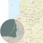
Map of the Sacred Valley and its attractions

Trek to Machu Picchu - the main attraction of Peru

Another map of the Sacred Valley
Transport issue
How to get to the attractions of the Sacred Valley of the Incas. Almost all objects can be reached by bus or collectively. We went to Machu Picchu by combi with other tourists, and to Choquequerao by regular bus, and reached the starting points of the route. So, having a Boleto Tourismo and having bought a ticket to Machu Picchu in advance, we made it much easier for us to move around the Sacred Valley. And of course, having chosen regular buses or minibuses, we almost never depended on other people. We spent as much time on the object as we wanted.
About tickets to Cusco and Machu Picchu
- We bought a ticket for Machu Picchu online (website, and it’s better to make a purchase on the Spanish page, then it will work properly!) about a month and a half before the expected visit. Our ticket also included a morning visit Huaynu Picchu. Cost: 157 soles (or $55).
- If you are satisfied only with yourself lost city Incas, without climbing the neighboring mountains (there is also the option Machu Picchu + Montagna, 140 soles), then such a ticket can be purchased locally or in Cusco (130 soles). If you arrived in Aguas Calientes during the day, you can buy a ticket to Machu Picchu for half a day, from 13:00, and it costs 50 soles. Climbing tickets must be purchased online, as a limited number of people are allowed to climb the mountains (400 per day).
- It’s also worth buying a five-day trek to Machu Picchu in advance if you want to walk the Inca Trail ( Inca trail). Access to the trail is also limited (200 people per day), so you should worry about it in advance, three or two months in advance. The cost of such a trip is from $600. This includes tickets to Machu Picchu and a return train ticket. We did not try this method, but went by combi + on foot. It turned out to be quite interesting too. And with big surprises! And we went trekking to Choquequirao!
- We visited all other sites using a single ticket (), which we also purchased in Cusco in Coricanchi Museum for 130 soles. Tickets must be paid separately for Salineras(7 soles) and on Choquequirao(37 soles). Both are purchased upon entry.
Photos of attractions

Sacsaywaman

Tambomachay

Puka Pukara

Temple of the Moon (Amaru marca wasi, Templo de la Luna)

Monkey Temple (Cusilluchayoc)

Kenko

Pikillacta

Rumicolca

Tipon

View of Machu Picchu from Huayna Picchu (Machu Picchu)

Pisac

Ollantaytambo

Salineras

Moray

Chinchero

Choquequirao
Reflections on the Incas
The diversity of the Sacred Valley confirmed the idea that not everything is so simple. Although the Incas controlled a vast territory and spread their building standards throughout the empire, even in this unity, inconsistencies are visible. The gulf between the Wari and the Incas becomes quite obvious. But there is also a gulf between the different Inca structures. And this can be seen in Pisak. Machu Picchu's younger sister Choquequirao indeed appears to be an imitation. All the canons are observed, but the scale is not at all the same.
When you study the architecture of Peru in detail and not only according to the standard program, a seditious thought creeps in that not only the Spaniards grabbed a delicious pie and built their churches on the ruins of Inca temples, but the Incas themselves did the same. Didn't they come prepared? Are not the buildings, which are simpler in terms of complexity, true Inca art, the art of imitation? Not only in the Sacred Valley, on the coast - all these buildings bear an external resemblance to the “Inca” style, but all this was not built so monumentally. There is no trace of unknown technologies, no megaliths were used. Everything is beautiful, but simple. Built from what was found at hand. Small stones in mountainous areas and burnt bricks in desert areas.
Perhaps what is attributed to the Wari is the Incas? And “Inca” is precisely the authorship of those unknown “gods” whom the Incas waited for but never received? We find traces of them, not only in Peru. And always and everywhere subsequent civilizations take credit for their achievements. Or to your enemies, whom you managed to subjugate. After all, it’s nice to defeat not a weak enemy, but a strong one.
The Sacred Valley of the Incas truly shows the diversity of cultures that lived in Peru. We will continue to call it the creation of the Incas, as is customary. But let us still keep another thought in mind: not everything is so simple and not everything is as it seems.
Peru, Urubamba, Peru
Show on the mapbasic information
The Urubamba Valley was sacred place for the Incas. It is famous for its rich history, beautiful nature and a lot of attractions. Urubamba extends between Cusco and legendary city Machu Picchu. Because of high level humidity, the valley boasts fertile soil with beautiful flora.
Here you can walk for a long time admiring the incredible scenery: high mountains, green fields, steep rivers and ancient Inca structures will make every photo stunning.
Main attractions
- The town of Rakchi, where you can see the Temple of Viracoche - a massive structure made of ancient stones
- Pisac is the first stop in the sacred valley. There is a colorful market in this town three times a week. But the main attraction of Pisac is the ancient Incan ruins
- - the main agricultural center of the Incas, and now it is the most Big City in the sacred valley
- The city of Ollantaytambo is interesting because local residents they live in houses dating back to the Inca Empire, having slightly rebuilt them. The main attraction of the city is the Temple Hill, made of stone blocks hewn and fitted to each other.
- The salt terraces of Salinas de Maras, built during the Incan era, are still used for salt extraction. Salt water flows from the mountain tops to the surface and settles in three thousand unusual stone reservoirs.
- Moray, located at an altitude of 3,500 meters above sea level, is famous for a huge complex of circular terraces built by the Incas for agricultural experiments. Ancient people observed how certain plants behaved at different altitudes
- Machu Picchu - this one ancient city, built high in the mountains, with many unexplained mysteries, is the main attraction of Peru, attracting tourists from all over the world
How to get there
- By bus from Grau bus station. Travel time is about 1.5 hours, cost is about 4 soles. Buses depart every 15 minutes
- Taxi from Cusco in an hour, cost 50 soles
Sacred Valley of the Incas. Travel notes from Peru April 15th, 2015

Blondes and brunettes, shy women, coquettes and harsh weathered men! I share with you travel notes about the Sacred Valley of the Incas in Peru. I write them on the go: in tuk-tuks and in groups, in markets and restaurants, and post them every day on Instagram.
How to get to Machu Picchu cheaply, the phenomenon of leggings in South America and what is “sweet tsemik”?

It's time to become truly famous. How can you do this on Instagram without food? No way! It's like show business without a bed. So, a fruit salad for $1.3 at the market in the Urubamba metropolis. Everything is organic, farm grown, and gluten free. The fruits are collected during the full moon on the slopes of the foggy Andes by specially trained dwarfs.

Pisak is a psychedelic valley. There are many yoga schools, shamans and enlightened adepts with glassy eyes. A huge part of tourists travel to Peru specifically for shamanic rituals. There are two of them: ayahuasca and san pedro. You could read about San Pedro from Castaneda. His books come with age 16, torment, unwashed long hair and a torn Aria T-shirt. And ayahuasca is a local psychedelic that temporarily blocks the liver. The substance should lead the test subject to enlightenment and answers to important questions. Bad trips happen too. In the Sacred Valley, all this shamanism has turned into a very profitable business. I am very far from drugs and esotericism, so I am not going to participate in this and, moreover, I will not organize ceremonies for our groups. But if you can’t imagine your life without dreadlocks, hashish and orange trousers, and in India you are wanted, Peru is waiting!

You can climb the mountain to the Pisak fortress on foot in two hours (a very hellish undertaking) or take a taxi for $7. Previously, I would definitely go on an expedition. But I feel like I’m already getting old. The old rage is gone. I’m not ready to chop for seven dollars. And once, without hesitation, I spent the night at the airport to save five.
But we went down on foot and saw crazy landscapes along the way. And they looked with sympathy at the people climbing up. In their eyes there was despair, decay and awareness of the meaninglessness of what was happening. I think the pilgrims went down by taxi.

I'm climbing up observation deck, and there is a lonely concert without spectators. Some say Pisac is better than Machu Picchu. It is strange that organized tours almost never visit it. Although the town is only 40 minutes from Cusco. We'll compare these two places soon.

If you look closely, you can see me in the photo wearing a discreet T-shirt with the words “Peru” written on it. I think about the fate of ancient civilizations and why we didn’t take sandwiches to the mountain. Thoughts about lunch were more persistent.

There are many jugglers roaming around South America. They earn extra money on the road: they stand in front of cars at intersections and entertain drivers. I saw them in both Bolivia and Argentina. And this guy is just playing with the local children. For me, the coolest thing about traveling is real life people, not a tourist trap, endless temples and views from glossy postcards.
Europeans who travel here have a lot of iPhones. Although there is clearly an opportunity to buy a fifth or sixth. They have a quality that is not particularly characteristic of us yet. People from first world countries take useful functionality from things and are indifferent to the status component. The legions of small cars in Europe like the Peugeot 207 are further proof. It is not customary to show off wealth. In our country, modesty is synonymous with poverty. Therefore, it is quite normal to buy a Range Rover as collateral for a tiny apartment on the outskirts in which you live with three children. Not to be, but to appear is the main motto of the society of new and fast money.
We already have a layer of wealthy people with different values. But there is still a lot of merchant revelry “for all the money” and like the last time.

Meet the Peruvian tuk-tuk. It differs from its Indian counterparts in its futuristic design and the presence of doors. For those who don’t know, this is a motorcycle with an attached body. I met them in India, Thailand, Cambodia, the Philippines and somewhere else, I don’t remember now. The Philippine tricycles are most similar to the Peruvian version. But in Peru it looks more solid - like a real sports car. Tuk-tuks are always cheaper than regular taxis. I know several stories about how guys in India bought this rattletrap for $1000 and traveled around the country on it for months.

A funny hour and a half in the minibus, and we arrived in Urubamba. In Argentina, travel between cities often took 25 hours. I know that you, like me, have long dreamed of this metropolis. For many years, sunny Urubamba adorned my school diary, and I decorated the walls of my cold den with its posters. And here I am! We go to see the Salinas salt mines (pictured) and the Inca agricultural laboratory of Moray. And to you - sweet tsemik and good day!
P.S. “Sweet Tsemik” is an alarming SMS that I once received from a girl with large breasts. I didn't see her again.

Moray - Incan agricultural laboratory. In this bucolic valley, Michurin’s predecessors conducted their ruthless experiments: they crossed arugula with basil, and tried to grow broccoli with the taste of spinach. At each level of the terraces there is a different soil and microclimate. This is where my knowledge of agriculture ends. I immediately remember Mark Twain's story "How I Edited an Agricultural Newspaper."

In Asia, all backpacker girls wear a simple uniform: flip-flops, shorts, a stretched T-shirt (sometimes two at once). In South America it is somewhat cooler (I am very tolerant), and for some reason most travelers travel around the cities in tights. At the same time, they are not at all shy about the legendary Latin American machos. As a man and an esthete, I support the new trend. But it would be more humane if leggings were not sold to everyone.

We moved to Olantaytambo. It took me about six months to learn this name.

Locals travel around the Sacred Valley in fairly comfortable minibuses. And we are with them: $0.5 for a 30-minute move. I haven’t seen any scary Asian-style local basses yet. In general, even Bolivia and Peru are significantly inferior to Asia in terms of color. But by nature South America much steeper (not counting the Himalayas).

Unpronounceable Olantaytambo turned out to be a cool medieval town built by the Incas. Here they are paved with paving stones narrow streets with channels through which clear (!) water gurgles. All this stuff comes from the Incas, 13th century. One hundred hotels and two hundred latte macchiato restaurants are a legacy of a later era.

We finally got to Agua Calientes (hot waters in our opinion). It was an epic trip. First, three hours on a bus along a hellish serpentine road - nowhere on the Bolivian Death Road. There were no seats, so Yulia sat on a stool, and I sat on the floor on a backpack. Then another 40 minutes along the road a la the Himalayas. And one more taxi, and then 2:45 walking along the rails, at the end - in the dark. Girls, who will go to the Girls in travel Peru bachelorette party - don’t worry, we’ll go by train. There are simply two options - a train for $100 and 4 hours or $11 and hemorrhoids for the whole day. And entrance to Machu Picchu is $55. And the bus up and down is another $24. They squeeze the maximum out of workers! But nothing will stop us. Tomorrow another dream will come true.

Machu Picchu lived up to expectations: a cosmic place. Especially early in the morning, when the clouds cover the city and then move away, and the bulk of the tourists have not yet arrived. I thought it would take all day, but we finished it in 5 hours. True, we did not climb any of the mountains (there are three types of tickets with different levels of access). Everything is well organized. It would have been very difficult to climb up on foot, we were happy that we went by bus. There are a lot of people, of course, and it’s not the season yet. For some reason, the llamas did not show up for work, and Yulina’s dreams of a photo shoot with a llama overlooking MP were dashed.

When I looked at photographs from Machu Picchu, I imagined giant queue to a single location for shooting. It turned out that there are a million options, many terraces, and everyone can fit in somewhere. Admiring the lost city from above is much cooler than wandering around it. There's nothing particularly photogenic there. If these ruins had been in a less picturesque place, I’m afraid they would not have become such an icon. But everything together creates an unreal impression!

The Spanish colonialists knew nothing about Machu Picchu. Having climbed into this distance, you understand why. In 1911, it was discovered quite accidentally by amateur researcher Hiram Bingham. I read about another lost city Inca, mini Machu Picchu. You have to go to him on a 4-day trek, which significantly reduces the number of visitors.

After Machu Picchu, instead of resting, we